This weather event on April 30, 2025 includes:
2 states
33 counties,
13 cities,
and 86 zip codes.
There were 49 total properties that were impacted and have possible damage.
States Impacted By Hail On April 30, 2025
Kansas
·
Nebraska
Counties Impacted By Hail On April 30, 2025
Barton, KS
·
Cloud, KS
·
Ellsworth, KS
·
Gove, KS
·
Jewell, KS
·
Lincoln, KS
·
Mitchell, KS
·
Ness, KS
·
Rawlins, KS
·
Russell, KS
·
Sheridan, KS
·
Thomas, KS
·
Trego, KS
·
Washington, KS
·
Blaine, NE
·
Buffalo, NE
·
Custer, NE
·
Dawson, NE
·
Frontier, NE
·
Furnas, NE
·
Garfield, NE
·
Gosper, NE
·
Greeley, NE
·
Hayes, NE
·
Hitchcock, NE
·
Howard, NE
·
Jefferson, NE
·
Lincoln, NE
·
Loup, NE
·
Phelps, NE
·
Sherman, NE
·
Valley, NE
·
Wheeler, NE
Cities Impacted By Hail On April 30, 2025
Arnold, NE
·
Cotesfield, NE
·
Endicott, NE
·
Farnam, NE
·
Gem, KS
·
Greeley Center, NE
·
Loup City, NE
·
Mason City, NE
·
North Platte, NE
·
Palmer, KS
·
Quinter, KS
·
Rexford, KS
·
Simpson, KS
Zip Codes Impacted By Hail On April 30, 2025
66937
·
66946
·
66953
·
66955
·
66958
·
66962
·
66963
·
66968
·
67420
·
67478
·
67490
·
67525
·
67544
·
67572
·
67584
·
67631
·
67634
·
67672
·
67701
·
67730
·
67734
·
67736
·
67737
·
67738
·
67740
·
67748
·
67751
·
67752
·
67753
·
67757
·
68342
·
68350
·
68352
·
68377
·
68622
·
68637
·
68665
·
68813
·
68814
·
68815
·
68817
·
68822
·
68823
·
68825
·
68833
·
68842
·
68844
·
68850
·
68852
·
68853
·
68855
·
68860
·
68863
·
68866
·
68869
·
68870
·
68875
·
68879
·
68922
·
68927
·
68937
·
68948
·
68976
·
69001
·
69022
·
69024
·
69025
·
69028
·
69029
·
69032
·
69040
·
69043
·
69044
·
69045
·
69101
·
69120
·
69123
·
69130
·
69132
·
69138
·
69151
·
69169
·
69170
·
68862
·
68835
·
67455
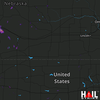 HASTINGS (KUEX) RADAR

