This weather event on April 30, 2025 includes:
4 states
25 counties,
17 cities,
and 71 zip codes.
There were 686 total properties that were impacted and have possible damage.
States Impacted By Hail On April 30, 2025
Kentucky
·
North Carolina
·
Tennessee
·
Virginia
Counties Impacted By Hail On April 30, 2025
Floyd, KY
·
Martin, KY
·
Pike, KY
·
Alleghany, NC
·
Avery, NC
·
Forsyth, NC
·
Guilford, NC
·
Stokes, NC
·
Surry, NC
·
Vance, NC
·
Warren, NC
·
Watauga, NC
·
Wilkes, NC
·
Yadkin, NC
·
Yancey, NC
·
Carter, TN
·
Unicoi, TN
·
Buchanan, VA
·
Carroll, VA
·
Dickenson, VA
·
Henry, VA
·
Patrick, VA
·
Russell, VA
·
Washington, VA
·
Wise, VA
Cities Impacted By Hail On April 30, 2025
East Bend, NC
·
Elkhorn City, KY
·
Elkin, NC
·
Foscoe, NC
·
Kernersville, NC
·
Lebanon, VA
·
Lowgap, NC
·
Martin, KY
·
Maytown, KY
·
Middleburg, NC
·
Mount Airy, NC
·
Pikeville, KY
·
Pleasant Hill, NC
·
Prestonsburg, KY
·
Ronda, NC
·
Seven Devils, NC
·
White Plains, NC
Zip Codes Impacted By Hail On April 30, 2025
24055
·
24076
·
24102
·
24171
·
24210
·
24224
·
24225
·
24256
·
24266
·
24273
·
24351
·
24603
·
24607
·
24614
·
24628
·
27007
·
27011
·
27016
·
27017
·
27018
·
27023
·
27024
·
27025
·
27030
·
27043
·
27046
·
27053
·
27055
·
27284
·
27537
·
27553
·
27563
·
28604
·
28607
·
28621
·
28622
·
28627
·
28635
·
28642
·
28644
·
28649
·
28651
·
28668
·
28669
·
28670
·
28676
·
28683
·
28714
·
28754
·
37640
·
37643
·
37650
·
37657
·
37658
·
37687
·
41250
·
41501
·
41522
·
41548
·
41571
·
41603
·
41619
·
41631
·
41635
·
41642
·
41645
·
41649
·
41653
·
41655
·
27556
·
27041
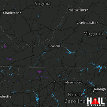 ROANOKE (KFCX) RADAR

