This weather event on April 30, 2025 includes:
4 states
30 counties,
12 cities,
and 56 zip codes.
There were 884 total properties that were impacted and have possible damage.
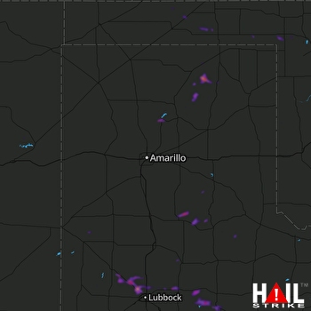 AMARILLO (KAMA) RADAR
States Impacted By Hail On April 30, 2025
Kansas
·
New Mexico
·
Oklahoma
·
Texas
Counties Impacted By Hail On April 30, 2025
Morton, KS
·
Harding, NM
·
Union, NM
·
Beaver, OK
·
Ellis, OK
·
Harper, OK
·
Roger Mills, OK
·
Texas, OK
·
Bailey, TX
·
Briscoe, TX
·
Crosby, TX
·
Dickens, TX
·
Donley, TX
·
Floyd, TX
·
Hale, TX
·
Hall, TX
·
Hansford, TX
·
Hartley, TX
·
Hockley, TX
·
Hutchinson, TX
·
Kent, TX
·
Lamb, TX
·
Lubbock, TX
·
Lynn, TX
·
Moore, TX
·
Motley, TX
·
Ochiltree, TX
·
Parmer, TX
·
Roberts, TX
·
Swisher, TX
Cities Impacted By Hail On April 30, 2025
Abernathy, TX
·
Anton, TX
·
Crosbyton, TX
·
Fritch, TX
·
Girard, TX
·
Lake Meredith Estates, TX
·
Lubbock, TX
·
May, OK
·
New Deal, TX
·
Ralls, TX
·
Shallowater, TX
·
Spur, TX
Zip Codes Impacted By Hail On April 30, 2025
79373
·
79339
·
67954
·
67953
·
73660
·
73843
·
73848
·
73851
·
73901
·
73931
·
73932
·
73942
·
73944
·
73945
·
73950
·
79007
·
79022
·
79031
·
79033
·
79036
·
79059
·
79070
·
79078
·
79080
·
79081
·
79083
·
79088
·
79093
·
79201
·
79226
·
79235
·
79241
·
79255
·
79257
·
79261
·
79311
·
79313
·
79322
·
79329
·
79336
·
79343
·
79347
·
79350
·
79357
·
79358
·
79363
·
79370
·
79403
·
79415
·
79416
·
79518
·
79528
·
88410
·
88415
·
88424
·
88426

