This weather event on April 29, 2025 includes:
2 states
26 counties,
18 cities,
and 60 zip codes.
There were total properties that were impacted and have possible damage.
States Impacted By Hail On April 29, 2025
Kentucky
·
Tennessee
Counties Impacted By Hail On April 29, 2025
Adair, KY
·
Allen, KY
·
Barren, KY
·
Clinton, KY
·
Cumberland, KY
·
Logan, KY
·
Metcalfe, KY
·
Monroe, KY
·
Simpson, KY
·
Todd, KY
·
Warren, KY
·
Wayne, KY
·
Benton, TN
·
Carroll, TN
·
Clay, TN
·
Decatur, TN
·
Dickson, TN
·
Hardin, TN
·
Henderson, TN
·
Houston, TN
·
Humphreys, TN
·
Macon, TN
·
Montgomery, TN
·
Perry, TN
·
Robertson, TN
·
Stewart, TN
Cities Impacted By Hail On April 29, 2025
Albany, KY
·
Bowling Green, KY
·
Burkesville, KY
·
Clarksville, TN
·
Dickson, TN
·
Edmonton, KY
·
Franklin, KY
·
Glasgow, KY
·
Guthrie, KY
·
Lexington, TN
·
Lobelville, TN
·
New Johnsonville, TN
·
Plano, KY
·
Plum Springs, KY
·
Saltillo, TN
·
Sardis, TN
·
Summer Shade, KY
·
Woodburn, KY
Zip Codes Impacted By Hail On April 29, 2025
37010
·
37032
·
37040
·
37042
·
37043
·
37051
·
37055
·
37061
·
37078
·
37079
·
37083
·
37096
·
37097
·
37101
·
37134
·
37150
·
37172
·
37185
·
37191
·
38328
·
38329
·
38341
·
38345
·
38351
·
38374
·
38380
·
38387
·
38388
·
38575
·
42101
·
42103
·
42104
·
42122
·
42129
·
42134
·
42151
·
42159
·
42160
·
42164
·
42166
·
42167
·
42170
·
42204
·
42206
·
42234
·
42256
·
42274
·
42276
·
42602
·
42633
·
42715
·
42717
·
42728
·
42731
·
38352
·
38363
·
38370
·
38371
·
42141
·
42171
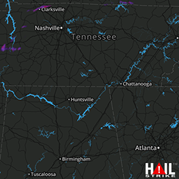 HUNTSVILLE (KHTX) RADAR

