This weather event on April 29, 2025 includes:
3 states
40 counties,
15 cities,
and 77 zip codes.
There were 2611 total properties that were impacted and have possible damage.
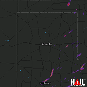 AMARILLO (KAMA) RADAR
States Impacted By Hail On April 29, 2025
Kansas
·
Oklahoma
·
Texas
Counties Impacted By Hail On April 29, 2025
Meade, KS
·
Beaver, OK
·
Beckham, OK
·
Ellis, OK
·
Harmon, OK
·
Harper, OK
·
Jackson, OK
·
Armstrong, TX
·
Bailey, TX
·
Briscoe, TX
·
Carson, TX
·
Childress, TX
·
Cochran, TX
·
Collingsworth, TX
·
Cottle, TX
·
Crosby, TX
·
Dickens, TX
·
Donley, TX
·
Floyd, TX
·
Foard, TX
·
Garza, TX
·
Gray, TX
·
Hall, TX
·
Hardeman, TX
·
Hemphill, TX
·
Hockley, TX
·
Kent, TX
·
King, TX
·
Knox, TX
·
Lamb, TX
·
Lipscomb, TX
·
Lubbock, TX
·
Lynn, TX
·
Motley, TX
·
Ochiltree, TX
·
Roberts, TX
·
Stonewall, TX
·
Swisher, TX
·
Terry, TX
·
Wheeler, TX
Cities Impacted By Hail On April 29, 2025
Amherst, TX
·
Beaver, OK
·
Clarendon, TX
·
Dickens, TX
·
Erick, OK
·
Floydada, TX
·
Girard, TX
·
Hollis, OK
·
Idalou, TX
·
Lorenzo, TX
·
Lubbock, TX
·
Paducah, TX
·
Post, TX
·
Quanah, TX
·
Shamrock, TX
Zip Codes Impacted By Hail On April 29, 2025
67864
·
73537
·
73544
·
73550
·
73571
·
73645
·
73840
·
73841
·
73843
·
73844
·
73848
·
73858
·
73932
·
73938
·
79011
·
79014
·
79019
·
79034
·
79039
·
79046
·
79054
·
79057
·
79059
·
79061
·
79065
·
79070
·
79079
·
79088
·
79094
·
79095
·
79096
·
79201
·
79220
·
79225
·
79226
·
79227
·
79230
·
79234
·
79235
·
79236
·
79237
·
79239
·
79241
·
79245
·
79248
·
79250
·
79252
·
79255
·
79256
·
79257
·
79258
·
79312
·
79316
·
79322
·
79324
·
79329
·
79343
·
79345
·
79346
·
79347
·
79356
·
79357
·
79358
·
79370
·
79371
·
79373
·
79381
·
79382
·
79403
·
79404
·
79412
·
79423
·
79424
·
79518
·
79528
·
79244
·
79229

