This weather event on April 29, 2025 includes:
3 states
12 counties,
25 cities,
and 42 zip codes.
There were total properties that were impacted and have possible damage.
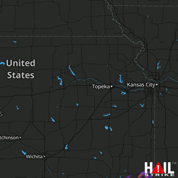 TOPEKA (KTWX) RADAR
States Impacted By Hail On April 29, 2025
Kansas
·
Missouri
·
Oklahoma
Counties Impacted By Hail On April 29, 2025
Chautauqua, KS
·
Cherokee, KS
·
Cowley, KS
·
Crawford, KS
·
Labette, KS
·
Montgomery, KS
·
Barton, MO
·
Vernon, MO
·
Kay, OK
·
Nowata, OK
·
Osage, OK
·
Washington, OK
Cities Impacted By Hail On April 29, 2025
Altamont, KS
·
Bartlett, KS
·
Caney, KS
·
Cedar Vale, KS
·
Cherokee, KS
·
Chicopee, KS
·
Coffeyville, KS
·
Dearing, KS
·
Edna, KS
·
Frontenac, KS
·
Havana, KS
·
Independence, KS
·
Irwin, MO
·
Labette, KS
·
Mindenmines, MO
·
Niotaze, KS
·
Oswego, KS
·
Parsons, KS
·
Pittsburg, KS
·
Roseland, KS
·
Scammon, KS
·
South Coffeyville, OK
·
Tyro, KS
·
Wann, OK
·
Weir, KS
Zip Codes Impacted By Hail On April 29, 2025
64759
·
64762
·
64769
·
64784
·
64832
·
66724
·
66725
·
66743
·
66753
·
66756
·
66762
·
66763
·
66773
·
66781
·
67024
·
67038
·
67301
·
67330
·
67332
·
67333
·
67335
·
67336
·
67337
·
67340
·
67342
·
67344
·
67347
·
67351
·
67352
·
67354
·
67355
·
67356
·
67357
·
67360
·
67361
·
67364
·
74022
·
74056
·
74072
·
74083
·
74647
·
74652

