This weather event on April 28, 2025 includes:
2 states
16 counties,
17 cities,
and 68 zip codes.
There were 1271 total properties that were impacted and have possible damage.
States Impacted By Hail On April 28, 2025
Minnesota
·
Wisconsin
Counties Impacted By Hail On April 28, 2025
Aitkin, MN
·
Carlton, MN
·
Cass, MN
·
Crow Wing, MN
·
Itasca, MN
·
Kanabec, MN
·
Lake, MN
·
Mille Lacs, MN
·
Pine, MN
·
St. Louis, MN
·
Ashland, WI
·
Barron, WI
·
Burnett, WI
·
Douglas, WI
·
Polk, WI
·
Washburn, WI
Cities Impacted By Hail On April 28, 2025
Duluth, MN
·
Esko, MN
·
Eveleth, MN
·
Floodwood, MN
·
Gilbert, MN
·
Hermantown, MN
·
Hibbing, MN
·
Hill City, MN
·
Meadowlands, MN
·
Mountain Iron, MN
·
Rice Lake, MN
·
Rock Creek, MN
·
Sandstone, MN
·
Shell Lake, WI
·
Superior, WI
·
Virginia, MN
·
Wrenshall, MN
Zip Codes Impacted By Hail On April 28, 2025
54514
·
54527
·
54546
·
54829
·
54830
·
54840
·
54850
·
54864
·
54871
·
54880
·
55006
·
55030
·
55037
·
55069
·
55072
·
55602
·
55603
·
55607
·
55616
·
55704
·
55705
·
55707
·
55712
·
55718
·
55720
·
55724
·
55733
·
55734
·
55735
·
55736
·
55738
·
55741
·
55744
·
55746
·
55748
·
55749
·
55750
·
55751
·
55756
·
55760
·
55763
·
55765
·
55767
·
55768
·
55779
·
55784
·
55785
·
55792
·
55793
·
55798
·
55802
·
55803
·
55804
·
55806
·
55810
·
55811
·
56342
·
56350
·
56431
·
56447
·
56469
·
56655
·
56662
·
56672
·
54849
·
55063
·
55797
·
56359
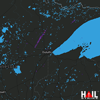 DULUTH (KDLH) RADAR

