This weather event on April 25, 2025 includes:
3 states
30 counties,
22 cities,
and 68 zip codes.
There were 1411 total properties that were impacted and have possible damage.
States Impacted By Hail On April 25, 2025
Louisiana
·
Mississippi
·
Texas
Counties Impacted By Hail On April 25, 2025
Avoyelles, LA
·
Calcasieu, LA
·
Caldwell, LA
·
Catahoula, LA
·
Concordia, LA
·
Evangeline, LA
·
Franklin, LA
·
Grant, LA
·
Jackson, LA
·
LaSalle, LA
·
Madison, LA
·
Natchitoches, LA
·
Ouachita, LA
·
Rapides, LA
·
Richland, LA
·
St. Landry, LA
·
Tensas, LA
·
West Carroll, LA
·
West Feliciana, LA
·
Winn, LA
·
Adams, MS
·
Amite, MS
·
Franklin, MS
·
Jefferson, MS
·
Wilkinson, MS
·
Hardin, TX
·
Liberty, TX
·
Newton, TX
·
Polk, TX
·
San Jacinto, TX
Cities Impacted By Hail On April 25, 2025
Banks Springs, LA
·
Bunkie, LA
·
Clarks, LA
·
Clayton, LA
·
Cloverdale, MS
·
Ferriday, LA
·
Grayson, LA
·
Harrisonburg, LA
·
Jonesville, LA
·
Minorca, LA
·
Montgomery, LA
·
Morgantown, MS
·
Natchez, MS
·
Olla, LA
·
Ridgecrest, LA
·
Rock Hill, LA
·
Sicily Island, LA
·
Spokane, LA
·
Vidalia, LA
·
Ville Platte, LA
·
Wallace Ridge, LA
·
Waterproof, LA
Zip Codes Impacted By Hail On April 25, 2025
39096
·
39120
·
39631
·
39638
·
39647
·
39653
·
39661
·
39664
·
39666
·
39669
·
70586
·
70661
·
70712
·
70775
·
71226
·
71232
·
71237
·
71238
·
71243
·
71259
·
71292
·
71295
·
71302
·
71316
·
71322
·
71326
·
71328
·
71334
·
71336
·
71340
·
71342
·
71343
·
71351
·
71355
·
71360
·
71366
·
71367
·
71368
·
71373
·
71375
·
71377
·
71378
·
71401
·
71409
·
71416
·
71417
·
71418
·
71425
·
71435
·
71441
·
71454
·
71456
·
71457
·
71465
·
71467
·
71473
·
71479
·
77351
·
77369
·
77371
·
77374
·
77376
·
77585
·
77612
·
77625
·
77327
·
71452
·
70782
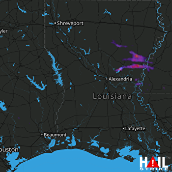 FORT POLK (KPOE) RADAR

