This weather event on April 24, 2025 includes:
3 states
25 counties,
20 cities,
and 57 zip codes.
There were 3034 total properties that were impacted and have possible damage.
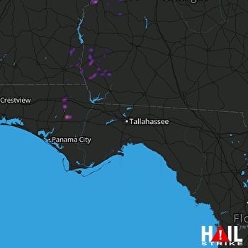 TALLAHASSEE (KTLH) RADAR
States Impacted By Hail On April 24, 2025
Alabama
·
Florida
·
Georgia
Counties Impacted By Hail On April 24, 2025
Barbour, AL
·
Henry, AL
·
Houston, AL
·
Russell, AL
·
Bay, FL
·
Calhoun, FL
·
Jackson, FL
·
Washington, FL
·
Baker, GA
·
Calhoun, GA
·
Chattahoochee, GA
·
Clay, GA
·
Early, GA
·
Houston, GA
·
Macon, GA
·
Marion, GA
·
Miller, GA
·
Muscogee, GA
·
Randolph, GA
·
Schley, GA
·
Seminole, GA
·
Stewart, GA
·
Sumter, GA
·
Taylor, GA
·
Webster, GA
Cities Impacted By Hail On April 24, 2025
Abbeville, AL
·
Alford, FL
·
Blakely, GA
·
Bluffton, GA
·
Buena Vista, GA
·
Colquitt, GA
·
Columbia, AL
·
Columbus, GA
·
Cottondale, FL
·
Cusseta-Chattahoochee County, GA
·
Gordon, AL
·
Haleburg, AL
·
Headland, AL
·
Jakin, GA
·
Kinsey, AL
·
Marianna, FL
·
Morgan, GA
·
Newville, AL
·
Webb, AL
·
Webster County, GA
Zip Codes Impacted By Hail On April 24, 2025
31006
·
31025
·
31041
·
31057
·
31063
·
31068
·
31076
·
31081
·
31719
·
31780
·
31801
·
31803
·
31805
·
31806
·
31814
·
31815
·
31821
·
31824
·
31825
·
32420
·
32421
·
32426
·
32428
·
32430
·
32431
·
32438
·
32443
·
32446
·
32448
·
36027
·
36301
·
36303
·
36310
·
36312
·
36319
·
36320
·
36343
·
36345
·
36353
·
36370
·
36373
·
36376
·
39813
·
39823
·
39824
·
39836
·
39837
·
39841
·
39845
·
39846
·
39851
·
39861
·
39862
·
39866
·
39870
·
31905
·
32442

