This weather event on April 24, 2025 includes:
3 states
31 counties,
26 cities,
and 60 zip codes.
There were 2419 total properties that were impacted and have possible damage.
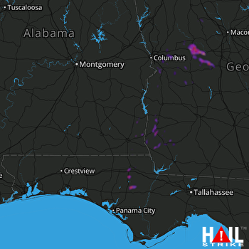 FORT RUCKER (KEOX) RADAR
States Impacted By Hail On April 24, 2025
Alabama
·
Florida
·
Georgia
Counties Impacted By Hail On April 24, 2025
Henry, AL
·
Houston, AL
·
Bay, FL
·
Calhoun, FL
·
Jackson, FL
·
Washington, FL
·
Baker, GA
·
Calhoun, GA
·
Chattahoochee, GA
·
Clay, GA
·
Crawford, GA
·
Dooly, GA
·
Early, GA
·
Harris, GA
·
Houston, GA
·
Lamar, GA
·
Macon, GA
·
Marion, GA
·
Miller, GA
·
Monroe, GA
·
Muscogee, GA
·
Peach, GA
·
Randolph, GA
·
Schley, GA
·
Seminole, GA
·
Stewart, GA
·
Sumter, GA
·
Talbot, GA
·
Taylor, GA
·
Upson, GA
·
Webster, GA
Cities Impacted By Hail On April 24, 2025
Abbeville, AL
·
Alford, FL
·
Americus, GA
·
Barnesville, GA
·
Blakely, GA
·
Bluffton, GA
·
Buena Vista, GA
·
Butler, GA
·
Cedar Springs, GA
·
Coleman, GA
·
Colquitt, GA
·
Columbia, AL
·
Columbus, GA
·
Cottondale, FL
·
Cottonwood, AL
·
Cusseta-Chattahoochee County, GA
·
Gordon, AL
·
Hannahs Mill, GA
·
Headland, AL
·
Marianna, FL
·
Morgan, GA
·
Newville, AL
·
Reynolds, GA
·
Thomaston, GA
·
Webb, AL
·
Webster County, GA
Zip Codes Impacted By Hail On April 24, 2025
30204
·
30286
·
31006
·
31007
·
31016
·
31025
·
31029
·
31030
·
31041
·
31057
·
31058
·
31063
·
31068
·
31076
·
31081
·
31097
·
31709
·
31719
·
31780
·
31801
·
31803
·
31805
·
31806
·
31812
·
31814
·
31815
·
31821
·
31824
·
31827
·
31829
·
31831
·
31905
·
32420
·
32421
·
32426
·
32430
·
32431
·
32438
·
32446
·
32448
·
36301
·
36310
·
36312
·
36319
·
36320
·
36343
·
36345
·
36353
·
36373
·
36376
·
39813
·
39823
·
39824
·
39836
·
39837
·
39841
·
39845
·
39851
·
39861
·
39866

