This weather event on April 23, 2025 includes:
2 states
17 counties,
20 cities,
and 71 zip codes.
There were 1024 total properties that were impacted and have possible damage.
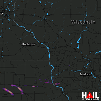 LA CROSSE (KARX) RADAR
States Impacted By Hail On April 23, 2025
Iowa
·
Wisconsin
Counties Impacted By Hail On April 23, 2025
Allamakee, IA
·
Benton, IA
·
Black Hawk, IA
·
Bremer, IA
·
Butler, IA
·
Clayton, IA
·
Fayette, IA
·
Franklin, IA
·
Grundy, IA
·
Hardin, IA
·
Tama, IA
·
Crawford, WI
·
Dane, WI
·
Grant, WI
·
Juneau, WI
·
Monroe, WI
·
Richland, WI
Cities Impacted By Hail On April 23, 2025
Ackley, IA
·
Alden, IA
·
Allison, IA
·
Bagley, WI
·
Bradford, IA
·
Bristow, IA
·
Cedar Falls, IA
·
Clutier, IA
·
Dumont, IA
·
Elgin, IA
·
Elkader, IA
·
Glen Haven, WI
·
Guttenberg, IA
·
Hudson, IA
·
Oelwein, IA
·
Richland Center, WI
·
St. Olaf, IA
·
Waterloo, IA
·
Waunakee, WI
·
Wellsburg, IA
Zip Codes Impacted By Hail On April 23, 2025
50006
·
50041
·
50126
·
50441
·
50601
·
50602
·
50604
·
50606
·
50607
·
50611
·
50613
·
50619
·
50622
·
50625
·
50629
·
50633
·
50638
·
50642
·
50647
·
50655
·
50662
·
50665
·
50668
·
50670
·
50671
·
50674
·
50675
·
50677
·
50680
·
50681
·
50701
·
50703
·
52043
·
52047
·
52048
·
52049
·
52052
·
52072
·
52077
·
52141
·
52142
·
52146
·
52147
·
52164
·
52169
·
52175
·
52217
·
52224
·
52229
·
52249
·
52346
·
52349
·
53581
·
53597
·
53801
·
53802
·
53804
·
53805
·
53806
·
53810
·
53813
·
53820
·
53950
·
54619
·
54626
·
54646
·
54648
·
54656
·
54670
·
50676
·
50660

