This weather event on April 23, 2025 includes:
2 states
17 counties,
23 cities,
and 55 zip codes.
There were 10452 total properties that were impacted and have possible damage.
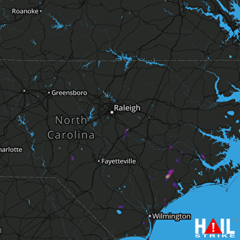 RALEIGH/DUR (KRAX) RADAR
States Impacted By Hail On April 23, 2025
North Carolina
·
South Carolina
Counties Impacted By Hail On April 23, 2025
Bladen, NC
·
Brunswick, NC
·
Columbus, NC
·
Craven, NC
·
Duplin, NC
·
Hoke, NC
·
Johnston, NC
·
Jones, NC
·
Lenoir, NC
·
Moore, NC
·
New Hanover, NC
·
Onslow, NC
·
Pamlico, NC
·
Pender, NC
·
Wayne, NC
·
Georgetown, SC
·
Horry, SC
Cities Impacted By Hail On April 23, 2025
Aberdeen, NC
·
Ashley Heights, NC
·
Belville, NC
·
Bridgeton, NC
·
Bucksport, SC
·
Fairfield Harbour, NC
·
Four Oaks, NC
·
Greenevers, NC
·
Hampstead, NC
·
Hightsville, NC
·
Jackson Heights, NC
·
Jacksonville, NC
·
Kinston, NC
·
Leland, NC
·
New Bern, NC
·
Pine Level, NC
·
Richlands, NC
·
Rocky Point, NC
·
Smithfield, NC
·
Southern Pines, NC
·
Tabor City, NC
·
Wilmington, NC
·
Wrightsboro, NC
Zip Codes Impacted By Hail On April 23, 2025
27520
·
27524
·
27568
·
27569
·
27576
·
27577
·
28315
·
28376
·
28387
·
28401
·
28403
·
28405
·
28409
·
28412
·
28422
·
28423
·
28425
·
28434
·
28442
·
28443
·
28444
·
28450
·
28451
·
28454
·
28456
·
28458
·
28463
·
28464
·
28466
·
28479
·
28501
·
28504
·
28518
·
28519
·
28521
·
28523
·
28525
·
28526
·
28530
·
28540
·
28547
·
28560
·
28562
·
28574
·
28585
·
29440
·
29527
·
29545
·
29554
·
29576
·
29585
·
27504
·
28333
·
28573
·
29588

