This weather event on April 22, 2025 includes:
2 states
16 counties,
29 cities,
and 67 zip codes.
There were 4807 total properties that were impacted and have possible damage.
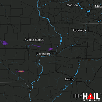 DAVENPORT (KDVN) RADAR
States Impacted By Hail On April 22, 2025
Iowa
·
Illinois
Counties Impacted By Hail On April 22, 2025
Appanoose, IA
·
Cedar, IA
·
Clinton, IA
·
Davis, IA
·
Henry, IA
·
Jefferson, IA
·
Johnson, IA
·
Marshall, IA
·
Muscatine, IA
·
Poweshiek, IA
·
Scott, IA
·
Story, IA
·
Tama, IA
·
Van Buren, IA
·
Wapello, IA
·
Whiteside, IL
Cities Impacted By Hail On April 22, 2025
Clarence, IA
·
Davenport, IA
·
Donahue, IA
·
Eldon, IA
·
Eldridge, IA
·
Fairfield, IA
·
Ferguson, IA
·
Floris, IA
·
Haverhill, IA
·
Le Grand, IA
·
Libertyville, IA
·
Lockridge, IA
·
Long Grove, IA
·
Marshalltown, IA
·
Maysville, IA
·
Melbourne, IA
·
Montour, IA
·
Park View, IA
·
Princeton, IA
·
Rome, IA
·
Solon, IA
·
State Center, IA
·
Stockton, IA
·
Tama, IA
·
Tipton, IA
·
Toledo, IA
·
Udell, IA
·
Unionville, IA
·
Walcott, IA
Zip Codes Impacted By Hail On April 22, 2025
50055
·
50056
·
50078
·
50106
·
50112
·
50120
·
50141
·
50142
·
50157
·
50158
·
50162
·
50173
·
50234
·
50247
·
52037
·
52211
·
52215
·
52216
·
52253
·
52254
·
52255
·
52306
·
52323
·
52333
·
52337
·
52342
·
52358
·
52533
·
52537
·
52544
·
52554
·
52556
·
52557
·
52560
·
52567
·
52571
·
52588
·
52593
·
52594
·
52635
·
52641
·
52651
·
52721
·
52730
·
52742
·
52745
·
52746
·
52747
·
52748
·
52753
·
52756
·
52758
·
52760
·
52761
·
52765
·
52766
·
52768
·
52769
·
52772
·
52773
·
52777
·
52778
·
52806
·
52807
·
61250
·
52339
·
52240

