This weather event on April 22, 2025 includes:
3 states
23 counties,
18 cities,
and 51 zip codes.
There were 1303 total properties that were impacted and have possible damage.
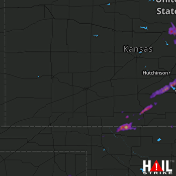 DODGE CITY (KDDC) RADAR
States Impacted By Hail On April 22, 2025
Kansas
·
Oklahoma
·
Texas
Counties Impacted By Hail On April 22, 2025
Barber, KS
·
Comanche, KS
·
Ellsworth, KS
·
Harper, KS
·
Harvey, KS
·
Kingman, KS
·
Lincoln, KS
·
Marion, KS
·
McPherson, KS
·
Ottawa, KS
·
Reno, KS
·
Saline, KS
·
Sedgwick, KS
·
Sumner, KS
·
Alfalfa, OK
·
Dewey, OK
·
Grant, OK
·
Harper, OK
·
Roger Mills, OK
·
Woods, OK
·
Hemphill, TX
·
Lipscomb, TX
·
Roberts, TX
Cities Impacted By Hail On April 22, 2025
Assaria, KS
·
Canadian, TX
·
Falun, KS
·
Halstead, KS
·
Haven, KS
·
Hesston, KS
·
Kingman, KS
·
Lindsborg, KS
·
Medicine Lodge, KS
·
Mount Hope, KS
·
Nashville, KS
·
Newton, KS
·
North Newton, KS
·
Pretty Prairie, KS
·
Renfrow, OK
·
Salina, KS
·
Tescott, KS
·
Zenda, KS
Zip Codes Impacted By Hail On April 22, 2025
67003
·
67018
·
67020
·
67022
·
67029
·
67035
·
67056
·
67057
·
67062
·
67065
·
67068
·
67070
·
67071
·
67104
·
67108
·
67112
·
67114
·
67117
·
67135
·
67138
·
67142
·
67155
·
67159
·
67401
·
67416
·
67418
·
67423
·
67425
·
67439
·
67442
·
67443
·
67448
·
67454
·
67456
·
67467
·
67484
·
67501
·
67543
·
67570
·
73642
·
73654
·
73717
·
73722
·
73758
·
73759
·
73771
·
73834
·
73835
·
73842
·
79014
·
79059

