This weather event on April 22, 2025 includes:
2 states
27 counties,
10 cities,
and 51 zip codes.
There were 3889 total properties that were impacted and have possible damage.
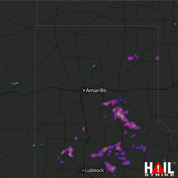 AMARILLO (KAMA) RADAR
States Impacted By Hail On April 22, 2025
Oklahoma
·
Texas
Counties Impacted By Hail On April 22, 2025
Ellis, OK
·
Roger Mills, OK
·
Armstrong, TX
·
Briscoe, TX
·
Castro, TX
·
Childress, TX
·
Cochran, TX
·
Cottle, TX
·
Crosby, TX
·
Dickens, TX
·
Donley, TX
·
Floyd, TX
·
Foard, TX
·
Hale, TX
·
Hall, TX
·
Hardeman, TX
·
Hemphill, TX
·
Hockley, TX
·
King, TX
·
Knox, TX
·
Lamb, TX
·
Lipscomb, TX
·
Lubbock, TX
·
Lynn, TX
·
Motley, TX
·
Roberts, TX
·
Swisher, TX
Cities Impacted By Hail On April 22, 2025
Clarendon, TX
·
Crosbyton, TX
·
Floydada, TX
·
Howardwick, TX
·
Littlefield, TX
·
Matador, TX
·
Paducah, TX
·
Petersburg, TX
·
Roaring Springs, TX
·
Spade, TX
Zip Codes Impacted By Hail On April 22, 2025
73642
·
73858
·
79014
·
79019
·
79032
·
79041
·
79043
·
79052
·
79059
·
79064
·
79072
·
79088
·
79201
·
79220
·
79225
·
79226
·
79227
·
79229
·
79231
·
79233
·
79234
·
79235
·
79236
·
79237
·
79239
·
79241
·
79243
·
79244
·
79245
·
79248
·
79250
·
79252
·
79256
·
79257
·
79259
·
79261
·
79311
·
79312
·
79313
·
79322
·
79326
·
79336
·
79339
·
79346
·
79357
·
79369
·
79370
·
79371
·
79373
·
79379
·
79380

