This weather event on April 22, 2025 includes:
2 states
14 counties,
26 cities,
and 63 zip codes.
There were 8134 total properties that were impacted and have possible damage.
States Impacted By Hail On April 22, 2025
Alabama
·
Mississippi
Counties Impacted By Hail On April 22, 2025
Blount, AL
·
Chilton, AL
·
Dallas, AL
·
Greene, AL
·
Hale, AL
·
Jefferson, AL
·
Perry, AL
·
Pickens, AL
·
Shelby, AL
·
St. Clair, AL
·
Sumter, AL
·
Talladega, AL
·
Kemper, MS
·
Noxubee, MS
Cities Impacted By Hail On April 22, 2025
Alabaster, AL
·
Bellamy, AL
·
Bessemer, AL
·
Boligee, AL
·
Brantleyville, AL
·
Brighton, AL
·
Childersburg, AL
·
Clanton, AL
·
Fayetteville, AL
·
Grayson Valley, AL
·
Helena, AL
·
Indian Springs Village, AL
·
Irondale, AL
·
Lincoln, AL
·
Montevallo, AL
·
Mountain Brook, AL
·
Pelham, AL
·
Pell City, AL
·
Riverside, AL
·
Shelby, AL
·
Sterrett, AL
·
Thorsby, AL
·
Trussville, AL
·
Vestavia Hills, AL
·
Vincent, AL
·
Westover, AL
Zip Codes Impacted By Hail On April 22, 2025
35007
·
35014
·
35020
·
35022
·
35043
·
35044
·
35045
·
35046
·
35051
·
35052
·
35054
·
35080
·
35096
·
35114
·
35115
·
35120
·
35121
·
35124
·
35125
·
35128
·
35135
·
35143
·
35147
·
35151
·
35160
·
35171
·
35173
·
35178
·
35206
·
35209
·
35210
·
35212
·
35213
·
35215
·
35216
·
35222
·
35223
·
35226
·
35235
·
35242
·
35243
·
35244
·
35442
·
35443
·
35459
·
35462
·
35464
·
35470
·
36744
·
36750
·
36759
·
36786
·
36901
·
39328
·
39341
·
39354
·
39358
·
39361
·
39739
·
39352
·
36740
·
35085
·
35040
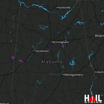 BIRMINGHAM (KBMX) RADAR

