This weather event on April 22, 2025 includes:
1 states
19 counties,
19 cities,
and 68 zip codes.
There were 1432 total properties that were impacted and have possible damage.
States Impacted By Hail On April 22, 2025
Iowa
Counties Impacted By Hail On April 22, 2025
Boone, IA
·
Carroll, IA
·
Dallas, IA
·
Emmet, IA
·
Floyd, IA
·
Greene, IA
·
Grundy, IA
·
Guthrie, IA
·
Hamilton, IA
·
Hardin, IA
·
Jasper, IA
·
Kossuth, IA
·
Marshall, IA
·
Palo Alto, IA
·
Polk, IA
·
Poweshiek, IA
·
Story, IA
·
Tama, IA
·
Webster, IA
Cities Impacted By Hail On April 22, 2025
Ames, IA
·
Bancroft, IA
·
Boxholm, IA
·
Churdan, IA
·
Conrad, IA
·
Hubbard, IA
·
Huxley, IA
·
Lincoln, IA
·
Luther, IA
·
New Providence, IA
·
Perry, IA
·
Pilot Mound, IA
·
Randall, IA
·
Ringsted, IA
·
Roland, IA
·
Sheldahl, IA
·
Slater, IA
·
Union, IA
·
Woodward, IA
Zip Codes Impacted By Hail On April 22, 2025
50010
·
50014
·
50026
·
50028
·
50029
·
50036
·
50039
·
50046
·
50050
·
50051
·
50058
·
50066
·
50075
·
50115
·
50122
·
50124
·
50127
·
50128
·
50129
·
50220
·
50223
·
50226
·
50230
·
50231
·
50235
·
50236
·
50243
·
50244
·
50246
·
50248
·
50249
·
50258
·
50276
·
50277
·
50278
·
50468
·
50517
·
50530
·
50539
·
50544
·
50559
·
50578
·
50609
·
50621
·
50627
·
50635
·
50636
·
50638
·
50652
·
50653
·
50669
·
50675
·
51342
·
51401
·
51430
·
51436
·
51443
·
51449
·
52342
·
50130
·
50148
·
50154
·
50156
·
50168
·
50171
·
50206
·
50208
·
50217
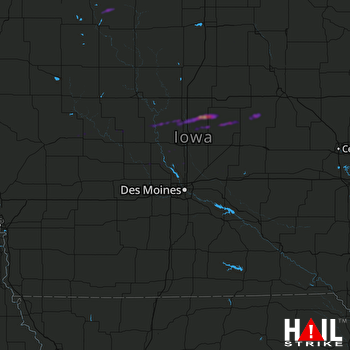 DES MOINES (KDMX) RADAR

