This weather event on April 18, 2025 includes:
1 states
29 counties,
19 cities,
and 86 zip codes.
There were 3376 total properties that were impacted and have possible damage.
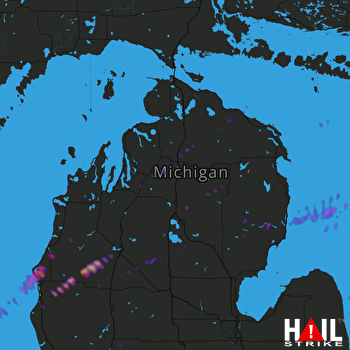 GAYLORD (KAPX) RADAR
States Impacted By Hail On April 18, 2025
Michigan
Counties Impacted By Hail On April 18, 2025
Alcona, MI
·
Alpena, MI
·
Antrim, MI
·
Arenac, MI
·
Benzie, MI
·
Cheboygan, MI
·
Clare, MI
·
Crawford, MI
·
Grand Traverse, MI
·
Huron, MI
·
Iosco, MI
·
Isabella, MI
·
Kalkaska, MI
·
Lake, MI
·
Manistee, MI
·
Mason, MI
·
Mecosta, MI
·
Missaukee, MI
·
Montcalm, MI
·
Montmorency, MI
·
Newaygo, MI
·
Oceana, MI
·
Ogemaw, MI
·
Osceola, MI
·
Oscoda, MI
·
Otsego, MI
·
Presque Isle, MI
·
Roscommon, MI
·
Wexford, MI
Cities Impacted By Hail On April 18, 2025
Alba, MI
·
Arcadia, MI
·
Custer, MI
·
Eastlake, MI
·
Filer City, MI
·
Howard City, MI
·
Kalkaska, MI
·
Lakes of the North, MI
·
Lakeview, MI
·
Le Roy, MI
·
Loomis, MI
·
Manistee, MI
·
Manton, MI
·
Oak Hill, MI
·
Pentwater, MI
·
Sterling, MI
·
Stronach, MI
·
Vanderbilt, MI
·
Wedgewood, MI
Zip Codes Impacted By Hail On April 18, 2025
49799
·
49795
·
49779
·
49765
·
49759
·
49756
·
49753
·
49746
·
49744
·
49738
·
49735
·
49730
·
49707
·
49690
·
49689
·
49688
·
49686
·
49683
·
49680
·
49677
·
49676
·
49668
·
49667
·
49665
·
49663
·
49660
·
49659
·
49657
·
49656
·
49655
·
49651
·
49649
·
49646
·
49645
·
49644
·
49635
·
49634
·
49632
·
49631
·
49626
·
49623
·
49619
·
49618
·
49616
·
49614
·
49613
·
49612
·
49601
·
49459
·
49458
·
49454
·
49449
·
49431
·
49420
·
49412
·
49411
·
49410
·
49405
·
49402
·
49343
·
49339
·
49329
·
49322
·
49310
·
49304
·
48850
·
48761
·
48750
·
48745
·
48739
·
48738
·
48737
·
48730
·
48661
·
48659
·
48656
·
48654
·
48653
·
48651
·
48647
·
48629
·
48625
·
48619
·
48617
·
48470
·
48441

