This weather event on April 18, 2025 includes:
2 states
16 counties,
25 cities,
and 52 zip codes.
There were 10369 total properties that were impacted and have possible damage.
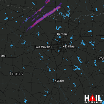 DALLAS/FTW (KFWS) RADAR
States Impacted By Hail On April 18, 2025
Oklahoma
·
Texas
Counties Impacted By Hail On April 18, 2025
Carter, OK
·
Coal, OK
·
Garvin, OK
·
Jefferson, OK
·
Johnston, OK
·
Love, OK
·
Marshall, OK
·
Murray, OK
·
Pontotoc, OK
·
Stephens, OK
·
Archer, TX
·
Clay, TX
·
Cooke, TX
·
Jack, TX
·
Montague, TX
·
Young, TX
Cities Impacted By Hail On April 18, 2025
Ada, OK
·
Ardmore, OK
·
Bellevue, TX
·
Bray, OK
·
Burneyville, OK
·
Clarita, OK
·
Dickson, OK
·
Duncan, OK
·
Elmore City, OK
·
Foster, OK
·
Healdton, OK
·
Henrietta, TX
·
Hickory, OK
·
Katie, OK
·
Leon, OK
·
Mannsville, OK
·
Nocona, TX
·
Nocona Hills, TX
·
Ratliff City, OK
·
Roff, OK
·
Ryan, OK
·
Scotland, TX
·
Tatums, OK
·
Velma, OK
·
Wynnewood, OK
Zip Codes Impacted By Hail On April 18, 2025
73456
·
73458
·
73463
·
73481
·
73487
·
73491
·
73030
·
73055
·
73075
·
73086
·
73098
·
73401
·
73430
·
73433
·
73434
·
73437
·
73438
·
73441
·
73442
·
73443
·
73444
·
73446
·
73447
·
73448
·
73453
·
73533
·
73565
·
73569
·
73573
·
74535
·
74538
·
74820
·
74836
·
74843
·
74856
·
74865
·
74871
·
76228
·
76230
·
76251
·
76255
·
76261
·
76265
·
76310
·
76351
·
76365
·
76374
·
76379
·
76389
·
76458
·
76459
·
76460

