This weather event on April 17, 2025 includes:
2 states
21 counties,
16 cities,
and 63 zip codes.
There were 1768 total properties that were impacted and have possible damage.
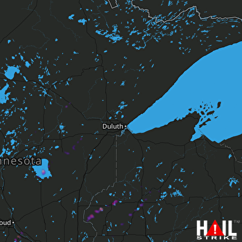 DULUTH (KDLH) RADAR
States Impacted By Hail On April 17, 2025
Minnesota
·
Wisconsin
Counties Impacted By Hail On April 17, 2025
Aitkin, MN
·
Carlton, MN
·
Crow Wing, MN
·
Itasca, MN
·
Lake, MN
·
Mille Lacs, MN
·
Sherburne, MN
·
Stearns, MN
·
St. Louis, MN
·
Washington, MN
·
Wright, MN
·
Ashland, WI
·
Barron, WI
·
Burnett, WI
·
Chippewa, WI
·
Dunn, WI
·
Polk, WI
·
Rusk, WI
·
Sawyer, WI
·
St. Croix, WI
·
Washburn, WI
Cities Impacted By Hail On April 17, 2025
Clear Lake, MN
·
Clearwater, MN
·
Crosslake, MN
·
Duluth, MN
·
Fifty Lakes, MN
·
Grant, MN
·
Hermantown, MN
·
Lake Elmo, MN
·
Marine on St. Croix, MN
·
Rice Lake, MN
·
Scandia, MN
·
Shell Lake, WI
·
Spooner, WI
·
Springbrook, WI
·
Vineland, MN
·
Webster, WI
Zip Codes Impacted By Hail On April 17, 2025
56442
·
56447
·
56448
·
56469
·
54001
·
54017
·
54020
·
54024
·
54025
·
54026
·
54517
·
54527
·
54724
·
54739
·
54751
·
54801
·
54810
·
54813
·
54819
·
54826
·
54829
·
54830
·
54837
·
54840
·
54843
·
54859
·
54871
·
54872
·
54875
·
54888
·
54893
·
54895
·
55042
·
55047
·
55073
·
55082
·
55319
·
55320
·
55382
·
55616
·
55726
·
55736
·
55742
·
55748
·
55749
·
55757
·
55760
·
55779
·
55783
·
55784
·
55787
·
55797
·
55798
·
55803
·
55810
·
55811
·
56301
·
56304
·
56342
·
56350
·
56359
·
56431
·
56441

