This weather event on April 10, 2025 includes:
3 states
21 counties,
12 cities,
and 66 zip codes.
There were total properties that were impacted and have possible damage.
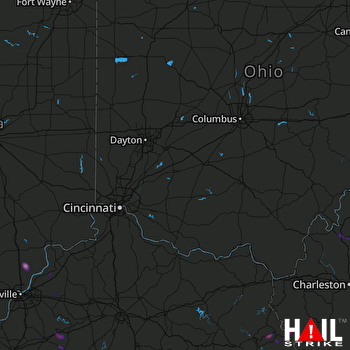 CINCINNATI (KILN) RADAR
States Impacted By Hail On April 10, 2025
Indiana
·
Kentucky
·
West Virginia
Counties Impacted By Hail On April 10, 2025
Clark, IN
·
Jefferson, IN
·
Scott, IN
·
Washington, IN
·
Boyle, KY
·
Fleming, KY
·
Floyd, KY
·
Johnson, KY
·
Knott, KY
·
Lawrence, KY
·
Martin, KY
·
Nelson, KY
·
Oldham, KY
·
Owen, KY
·
Pike, KY
·
Shelby, KY
·
Washington, KY
·
Jackson, WV
·
Mingo, WV
·
Roane, WV
·
Wayne, WV
Cities Impacted By Hail On April 10, 2025
Bardstown, KY
·
Betsy Layne, KY
·
Bloomfield, KY
·
Coal Run Village, KY
·
Danville, KY
·
Henryville, IN
·
Kermit, WV
·
La Grange, KY
·
Ripley, WV
·
Scottsburg, IN
·
Springfield, KY
·
Warfield, KY
Zip Codes Impacted By Hail On April 10, 2025
25239
·
25241
·
25243
·
25244
·
25248
·
25252
·
25271
·
25511
·
25666
·
25669
·
25674
·
25699
·
26164
·
40004
·
40008
·
40013
·
40014
·
40031
·
40065
·
40067
·
40069
·
40077
·
40078
·
40245
·
40359
·
40422
·
41010
·
41049
·
41203
·
41204
·
41214
·
41224
·
41230
·
41231
·
41240
·
41250
·
41254
·
41255
·
41257
·
41262
·
41263
·
41267
·
41271
·
41501
·
41603
·
41605
·
41615
·
41630
·
41635
·
41640
·
41659
·
41663
·
41722
·
41772
·
41839
·
47102
·
47111
·
47120
·
47126
·
47141
·
47143
·
47163
·
47167
·
47170
·
47177
·
47250

