This weather event on April 6, 2025 includes:
3 states
27 counties,
22 cities,
and 73 zip codes.
There were 929 total properties that were impacted and have possible damage.
States Impacted By Hail On April 6, 2025
Alabama
·
Florida
·
Georgia
Counties Impacted By Hail On April 6, 2025
Baldwin, AL
·
Barbour, AL
·
Coffee, AL
·
Dale, AL
·
Geneva, AL
·
Lee, AL
·
Lowndes, AL
·
Wilcox, AL
·
Holmes, FL
·
Bibb, GA
·
Coweta, GA
·
Crawford, GA
·
Fayette, GA
·
Harris, GA
·
Houston, GA
·
Lamar, GA
·
Macon, GA
·
Meriwether, GA
·
Muscogee, GA
·
Peach, GA
·
Pike, GA
·
Schley, GA
·
Spalding, GA
·
Talbot, GA
·
Taylor, GA
·
Twiggs, GA
·
Upson, GA
Cities Impacted By Hail On April 6, 2025
Ariton, AL
·
Bay Minette, AL
·
Brooks, GA
·
Columbus, GA
·
Concord, GA
·
Fort Rucker, AL
·
Geneva, GA
·
Haralson, GA
·
Hartford, AL
·
Hilltop, GA
·
Junction City, GA
·
Knoxville, GA
·
Macon-Bibb County, GA
·
Ozark, AL
·
Phenix City, AL
·
Roberta, GA
·
Salem, GA
·
Smiths Station, AL
·
Talbotton, GA
·
White Hall, AL
·
Woodbury, GA
·
Zebulon, GA
Zip Codes Impacted By Hail On April 6, 2025
30205
·
30206
·
30218
·
30222
·
30224
·
30251
·
30257
·
30258
·
30259
·
30276
·
30286
·
30292
·
30293
·
30295
·
31006
·
31008
·
31016
·
31020
·
31030
·
31041
·
31050
·
31052
·
31057
·
31063
·
31066
·
31076
·
31078
·
31081
·
31098
·
31201
·
31204
·
31206
·
31207
·
31210
·
31211
·
31213
·
31216
·
31217
·
31220
·
31801
·
31804
·
31806
·
31807
·
31808
·
31810
·
31812
·
31820
·
31827
·
31829
·
31831
·
31904
·
31907
·
31909
·
32455
·
36017
·
36040
·
36048
·
36311
·
36344
·
36350
·
36352
·
36353
·
36360
·
36362
·
36374
·
36375
·
36507
·
36726
·
36766
·
36768
·
36867
·
36877
·
30223
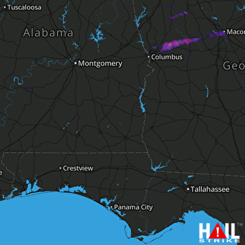 FORT RUCKER (KEOX) RADAR

