This weather event on April 5, 2025 includes:
2 states
19 counties,
20 cities,
and 48 zip codes.
There were total properties that were impacted and have possible damage.
States Impacted By Hail On April 5, 2025
Kentucky
·
Tennessee
Counties Impacted By Hail On April 5, 2025
Allen, KY
·
Logan, KY
·
Simpson, KY
·
Todd, KY
·
Warren, KY
·
Benton, TN
·
Cheatham, TN
·
Davidson, TN
·
Dickson, TN
·
Hickman, TN
·
Houston, TN
·
Humphreys, TN
·
Jackson, TN
·
Macon, TN
·
Montgomery, TN
·
Robertson, TN
·
Smith, TN
·
Stewart, TN
·
Sumner, TN
Cities Impacted By Hail On April 5, 2025
Adams, TN
·
Ashland City, TN
·
Camden, TN
·
Cedar Hill, TN
·
Clarksville, TN
·
Coopertown, TN
·
Cottontown, TN
·
Cumberland City, TN
·
Erin, TN
·
Franklin, KY
·
Graball, TN
·
Greenbrier, TN
·
Nashville-Davidson metropolitan government (balance), TN
·
New Deal, TN
·
Pleasant View, TN
·
Springfield, TN
·
Tennessee Ridge, TN
·
Walnut Grove, TN
·
Waverly, TN
·
White House, TN
Zip Codes Impacted By Hail On April 5, 2025
37015
·
37022
·
37030
·
37032
·
37035
·
37036
·
37040
·
37043
·
37048
·
37050
·
37051
·
37052
·
37055
·
37061
·
37066
·
37073
·
37075
·
37080
·
37083
·
37101
·
37134
·
37142
·
37145
·
37146
·
37148
·
37171
·
37172
·
37175
·
37178
·
37181
·
37185
·
37187
·
37188
·
38221
·
38320
·
38333
·
38341
·
38562
·
38588
·
42104
·
42122
·
42134
·
42164
·
42206
·
42274
·
42286
·
37010
·
37042
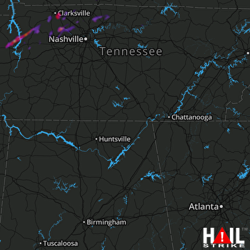 HUNTSVILLE (KHTX) RADAR

