This weather event on April 4, 2025 includes:
4 states
35 counties,
13 cities,
and 71 zip codes.
There were 7292 total properties that were impacted and have possible damage.
States Impacted By Hail On April 4, 2025
Illinois
·
Indiana
·
Kentucky
·
Tennessee
Counties Impacted By Hail On April 4, 2025
Gallatin, IL
·
Saline, IL
·
White, IL
·
Daviess, IN
·
Gibson, IN
·
Harrison, IN
·
Perry, IN
·
Pike, IN
·
Posey, IN
·
Spencer, IN
·
Vanderburgh, IN
·
Warrick, IN
·
Breckinridge, KY
·
Bullitt, KY
·
Butler, KY
·
Christian, KY
·
Daviess, KY
·
Estill, KY
·
Hardin, KY
·
Henderson, KY
·
Jackson, KY
·
Logan, KY
·
Madison, KY
·
McLean, KY
·
Meade, KY
·
Mercer, KY
·
Taylor, KY
·
Todd, KY
·
Trigg, KY
·
Union, KY
·
Washington, KY
·
Webster, KY
·
Wolfe, KY
·
Montgomery, TN
·
Stewart, TN
Cities Impacted By Hail On April 4, 2025
Brandenburg, KY
·
Evansville, IN
·
Francisco, IN
·
Highland, IN
·
Hopkinsville, KY
·
LaFayette, KY
·
Lewisburg, KY
·
Mackville, KY
·
Maunie, IL
·
Melody Hill, IN
·
Owensboro, KY
·
Owensville, IN
·
Uniontown, KY
Zip Codes Impacted By Hail On April 4, 2025
37023
·
37028
·
37058
·
40069
·
40108
·
40121
·
40165
·
40170
·
40176
·
40177
·
40272
·
40330
·
40336
·
40385
·
40403
·
40447
·
41301
·
41365
·
42211
·
42217
·
42220
·
42236
·
42240
·
42254
·
42256
·
42262
·
42266
·
42276
·
42280
·
42301
·
42303
·
42327
·
42406
·
42420
·
42452
·
42455
·
42461
·
42462
·
42716
·
47112
·
47117
·
47135
·
47501
·
47551
·
47558
·
47564
·
47567
·
47585
·
47613
·
47620
·
47635
·
47648
·
47649
·
47660
·
47665
·
47708
·
47710
·
47711
·
47712
·
47715
·
47720
·
47725
·
62821
·
62861
·
62934
·
62954
·
62984
·
40040
·
42718
·
47610
·
47670
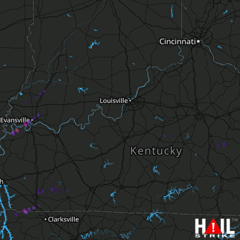 LOUISVILLE (KLVX) RADAR

