This weather event on April 3, 2025 includes:
5 states
20 counties,
13 cities,
and 49 zip codes.
There were total properties that were impacted and have possible damage.
States Impacted By Hail On April 3, 2025
Illinois
·
Indiana
·
Kentucky
·
Missouri
·
Tennessee
Counties Impacted By Hail On April 3, 2025
Alexander, IL
·
Jackson, IL
·
Lawrence, IL
·
Union, IL
·
Williamson, IL
·
Knox, IN
·
Allen, KY
·
Barren, KY
·
Christian, KY
·
Green, KY
·
Hickman, KY
·
Metcalfe, KY
·
Monroe, KY
·
Simpson, KY
·
Todd, KY
·
Warren, KY
·
Cape Girardeau, MO
·
Montgomery, TN
·
Stewart, TN
·
Sumner, TN
Cities Impacted By Hail On April 3, 2025
Clarksville, TN
·
Fairview, KY
·
Fort Campbell North, KY
·
Franklin, KY
·
Glasgow, KY
·
Guthrie, KY
·
Hopkinsville, KY
·
Mitchellville, TN
·
Oak Grove, KY
·
Pembroke, KY
·
Portland, TN
·
Summer Shade, KY
·
Woodburn, KY
Zip Codes Impacted By Hail On April 3, 2025
37040
·
37042
·
37079
·
37148
·
37186
·
37191
·
42031
·
42088
·
42103
·
42104
·
42120
·
42123
·
42129
·
42130
·
42133
·
42134
·
42141
·
42154
·
42156
·
42157
·
42159
·
42160
·
42164
·
42166
·
42167
·
42170
·
42171
·
42204
·
42214
·
42220
·
42223
·
42234
·
42236
·
42240
·
42262
·
42266
·
42286
·
42743
·
47561
·
62417
·
62466
·
62902
·
62906
·
62920
·
62924
·
62932
·
62952
·
62957
·
63701
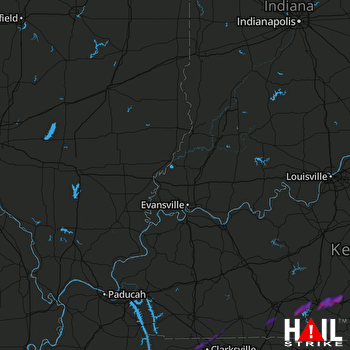 EVANSVILLE (KVWX) RADAR

