This weather event on April 2, 2025 includes:
2 states
26 counties,
20 cities,
and 62 zip codes.
There were total properties that were impacted and have possible damage.
States Impacted By Hail On April 2, 2025
Florida
·
Georgia
Counties Impacted By Hail On April 2, 2025
Alachua, FL
·
Marion, FL
·
Appling, GA
·
Atkinson, GA
·
Bacon, GA
·
Ben Hill, GA
·
Berrien, GA
·
Brooks, GA
·
Candler, GA
·
Coffee, GA
·
Cook, GA
·
Dodge, GA
·
Emanuel, GA
·
Irwin, GA
·
Jeff Davis, GA
·
Lanier, GA
·
Laurens, GA
·
Lowndes, GA
·
Montgomery, GA
·
Tattnall, GA
·
Telfair, GA
·
Tift, GA
·
Toombs, GA
·
Turner, GA
·
Wheeler, GA
·
Wilcox, GA
Cities Impacted By Hail On April 2, 2025
Adel, GA
·
Ailey, GA
·
Ambrose, GA
·
Chauncey, GA
·
Eastman, GA
·
Enigma, GA
·
Hahira, GA
·
Hazlehurst, GA
·
Higgston, GA
·
Lumber City, GA
·
Lyons, GA
·
Milan, GA
·
Mount Vernon, GA
·
Oak Park, GA
·
Ocilla, GA
·
Sparks, GA
·
Stillmore, GA
·
Unionville, GA
·
Vidalia, GA
·
Willacoochee, GA
Zip Codes Impacted By Hail On April 2, 2025
30401
·
30410
·
30411
·
30412
·
30420
·
30428
·
30439
·
30445
·
30464
·
30471
·
30473
·
30474
·
30475
·
31009
·
31011
·
31023
·
31037
·
31055
·
31060
·
31077
·
31079
·
31510
·
31512
·
31513
·
31519
·
31532
·
31533
·
31535
·
31539
·
31549
·
31554
·
31567
·
31605
·
31620
·
31622
·
31625
·
31632
·
31635
·
31637
·
31638
·
31639
·
31641
·
31642
·
31645
·
31647
·
31650
·
31733
·
31749
·
31750
·
31774
·
31783
·
31790
·
31793
·
31794
·
31798
·
32113
·
32609
·
32617
·
32640
·
32641
·
31001
·
30436
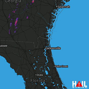 JACKSONVILLE (KJAX) RADAR

