This weather event on March 28, 2025 includes:
3 states
20 counties,
23 cities,
and 64 zip codes.
There were 1214 total properties that were impacted and have possible damage.
States Impacted By Hail On March 28, 2025
Iowa
·
Minnesota
·
Wisconsin
Counties Impacted By Hail On March 28, 2025
Allamakee, IA
·
Howard, IA
·
Mitchell, IA
·
Winneshiek, IA
·
Dakota, MN
·
Dodge, MN
·
Faribault, MN
·
Fillmore, MN
·
Freeborn, MN
·
Houston, MN
·
Mower, MN
·
Olmsted, MN
·
Steele, MN
·
Wabasha, MN
·
Waseca, MN
·
Winona, MN
·
Buffalo, WI
·
La Crosse, WI
·
St. Croix, WI
·
Trempealeau, WI
Cities Impacted By Hail On March 28, 2025
Albert Lea, MN
·
Alden, MN
·
Austin, MN
·
Bricelyn, MN
·
Buffalo City, WI
·
Burnsville, MN
·
Chatfield, MN
·
Chester, IA
·
Claremont, MN
·
Conger, MN
·
Dover, MN
·
Ellendale, MN
·
Hammond, WI
·
Harmony, MN
·
Hayward, MN
·
Hokah, MN
·
La Crescent, MN
·
La Crosse, WI
·
Le Roy, MN
·
Mapleview, MN
·
Minneiska, MN
·
Spring Grove, MN
·
Walters, MN
Zip Codes Impacted By Hail On March 28, 2025
54015
·
54601
·
54622
·
54630
·
54658
·
54661
·
55901
·
55906
·
55910
·
55912
·
55917
·
55918
·
55921
·
55922
·
55923
·
55924
·
55925
·
55926
·
55929
·
55935
·
55936
·
55939
·
55941
·
55943
·
55947
·
55951
·
55954
·
55957
·
55960
·
55961
·
55965
·
55967
·
55973
·
55974
·
55975
·
55979
·
55985
·
55987
·
55991
·
56007
·
56009
·
56043
·
56051
·
56072
·
50466
·
52101
·
52134
·
52136
·
52140
·
52155
·
52160
·
52172
·
54002
·
55041
·
55337
·
55932
·
55949
·
55972
·
55976
·
56014
·
56020
·
56026
·
56042
·
56097
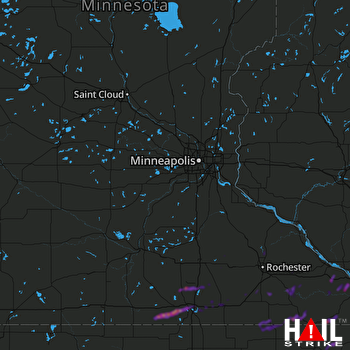 MINNEAPOLIS (KMPX) RADAR

