This weather event on March 27, 2025 includes:
2 states
17 counties,
20 cities,
and 51 zip codes.
There were 1272 total properties that were impacted and have possible damage.
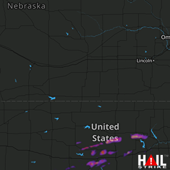 HASTINGS (KUEX) RADAR
States Impacted By Hail On March 27, 2025
Kansas
·
Nebraska
Counties Impacted By Hail On March 27, 2025
Barton, KS
·
Brown, KS
·
Clay, KS
·
Cloud, KS
·
Dickinson, KS
·
Ellsworth, KS
·
Geary, KS
·
Lincoln, KS
·
Nemaha, KS
·
Ness, KS
·
Osborne, KS
·
Ottawa, KS
·
Riley, KS
·
Rush, KS
·
Russell, KS
·
Saline, KS
·
Richardson, NE
Cities Impacted By Hail On March 27, 2025
Ada, KS
·
Barnard, KS
·
Bazine, KS
·
Beverly, KS
·
Brookville, KS
·
Chapman, KS
·
Clay Center, KS
·
Culver, KS
·
Delphos, KS
·
Ellsworth, KS
·
Galatia, KS
·
Grandview Plaza, KS
·
Holyrood, KS
·
Junction City, KS
·
Kanopolis, KS
·
Lucas, KS
·
Riley, KS
·
Solomon, KS
·
Sylvan Grove, KS
·
Talmage, KS
Zip Codes Impacted By Hail On March 27, 2025
66515
·
66531
·
67422
·
67423
·
67425
·
67431
·
67432
·
67444
·
67445
·
67454
·
67455
·
67459
·
67464
·
67466
·
67467
·
67470
·
67480
·
67482
·
67484
·
67485
·
67487
·
67490
·
67513
·
67516
·
67520
·
67521
·
67544
·
67548
·
67553
·
67556
·
67559
·
67564
·
68433
·
67665
·
67649
·
67648
·
67640
·
67634
·
67626
·
67565
·
67481
·
67450
·
67439
·
67436
·
67418
·
67410
·
67401
·
66534
·
66449
·
66442
·
66441

