This weather event on March 27, 2025 includes:
4 states
18 counties,
21 cities,
and 67 zip codes.
There were 1658 total properties that were impacted and have possible damage.
States Impacted By Hail On March 27, 2025
Iowa
·
Kansas
·
Missouri
·
Nebraska
Counties Impacted By Hail On March 27, 2025
Adams, IA
·
Cass, IA
·
Decatur, IA
·
Montgomery, IA
·
Page, IA
·
Pottawattamie, IA
·
Ringgold, IA
·
Shelby, IA
·
Taylor, IA
·
Union, IA
·
Jackson, KS
·
Atchison, MO
·
Gentry, MO
·
Harrison, MO
·
Nodaway, MO
·
Worth, MO
·
Pawnee, NE
·
Richardson, NE
Cities Impacted By Hail On March 27, 2025
Albany, MO
·
Bethany, MO
·
Blanchard, MO
·
Blythedale, MO
·
Braddyville, IA
·
Burlington Junction, MO
·
Clearmont, MO
·
Darlington, MO
·
Diagonal, IA
·
Eagleville, MO
·
Elmo, MO
·
Grant City, MO
·
Hancock, IA
·
Hopkins, MO
·
Irena, MO
·
Maloy, IA
·
New Hampton, MO
·
Nodaway, IA
·
Parnell, MO
·
Pickering, MO
·
Sharpsburg, IA
Zip Codes Impacted By Hail On March 27, 2025
50140
·
50859
·
50860
·
64424
·
64426
·
64428
·
64431
·
64438
·
64441
·
64442
·
64453
·
64456
·
64458
·
64461
·
64467
·
64471
·
64475
·
64476
·
64479
·
64481
·
64486
·
64489
·
64498
·
64499
·
64632
·
64657
·
64670
·
66418
·
66440
·
66509
·
68345
·
68355
·
68376
·
68431
·
68433
·
68457
·
50022
·
50133
·
50833
·
50835
·
50836
·
50840
·
50841
·
50843
·
50845
·
50848
·
50851
·
50853
·
50854
·
50857
·
50862
·
50864
·
51521
·
51532
·
51535
·
51536
·
51537
·
51544
·
51560
·
51566
·
51573
·
51577
·
51630
·
51631
·
51632
·
64402
·
64445
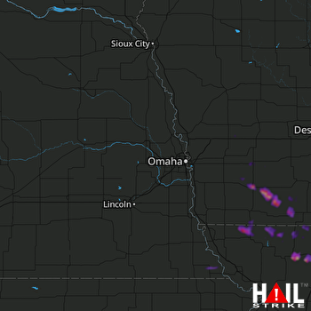 OMAHA (KOAX) RADAR

