This weather event on March 19, 2025 includes:
3 states
18 counties,
23 cities,
and 60 zip codes.
There were total properties that were impacted and have possible damage.
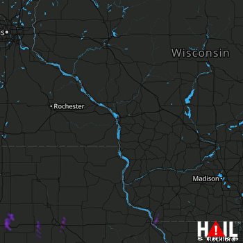 LA CROSSE (KARX) RADAR
States Impacted By Hail On March 19, 2025
Iowa
·
Illinois
·
Wisconsin
Counties Impacted By Hail On March 19, 2025
Benton, IA
·
Black Hawk, IA
·
Butler, IA
·
Cedar, IA
·
Clinton, IA
·
Dubuque, IA
·
Franklin, IA
·
Grundy, IA
·
Hardin, IA
·
Johnson, IA
·
Jones, IA
·
Linn, IA
·
Marshall, IA
·
Scott, IA
·
Tama, IA
·
Jo Daviess, IL
·
Whiteside, IL
·
Grant, WI
Cities Impacted By Hail On March 19, 2025
Anamosa, IA
·
Atkins, IA
·
Bertram, IA
·
Bradford, IA
·
Cedar Rapids, IA
·
Clinton, IA
·
East Dubuque, IL
·
Ely, IA
·
Evansdale, IA
·
Grundy Center, IA
·
Iowa Falls, IA
·
Marion, IA
·
Morrison, IA
·
Owasa, IA
·
Raymond, IA
·
Robins, IA
·
Sandy Hook, WI
·
Shueyville, IA
·
Stone City, IA
·
Stout, IA
·
Swisher, IA
·
Waterloo, IA
·
Wheatland, IA
Zip Codes Impacted By Hail On March 19, 2025
50642
·
50648
·
50673
·
50701
·
50702
·
50703
·
50707
·
52003
·
52068
·
52205
·
52206
·
52214
·
52224
·
52227
·
52228
·
52229
·
52302
·
52310
·
52324
·
52328
·
52333
·
52336
·
52338
·
52402
·
52403
·
52404
·
52405
·
52411
·
52721
·
52729
·
52732
·
52745
·
52765
·
52777
·
53807
·
53811
·
53818
·
61025
·
61252
·
50006
·
50041
·
50126
·
50158
·
50420
·
50441
·
50452
·
50601
·
50624
·
50626
·
50627
·
50632
·
50633
·
50635
·
50638
·
50651
·
50660
·
50665
·
50667
·
50669
·
50670

