This weather event on March 16, 2025 includes:
3 states
22 counties,
24 cities,
and 45 zip codes.
There were 1134 total properties that were impacted and have possible damage.
States Impacted By Hail On March 16, 2025
Florida
·
Georgia
·
South Carolina
Counties Impacted By Hail On March 16, 2025
Alachua, FL
·
Baker, FL
·
Brevard, FL
·
Columbia, FL
·
Duval, FL
·
Flagler, FL
·
Hernando, FL
·
Nassau, FL
·
St. Johns, FL
·
Brantley, GA
·
Bryan, GA
·
Camden, GA
·
Charlton, GA
·
Chatham, GA
·
Clinch, GA
·
Glynn, GA
·
Liberty, GA
·
Long, GA
·
McIntosh, GA
·
Ware, GA
·
Wayne, GA
·
Jasper, SC
Cities Impacted By Hail On March 16, 2025
Archer, FL
·
Bayport, FL
·
Dutch Island, GA
·
Isle of Hope, GA
·
Jacksonville, FL
·
Lake City, FL
·
Midway, GA
·
Montgomery, GA
·
Nassau Village-Ratliff, FL
·
Newberry, FL
·
North Weeki Wachee, FL
·
Palm Coast, FL
·
Pine Island, FL
·
Savannah, GA
·
Skidaway Island, GA
·
Talahi Island, GA
·
Thunderbolt, GA
·
Vernonburg, GA
·
Watertown, FL
·
Waycross, GA
·
Weeki Wachee Gardens, FL
·
Whitemarsh Island, GA
·
Wilmington Island, GA
·
Yulee, FL
Zip Codes Impacted By Hail On March 16, 2025
31316
·
31320
·
31323
·
31324
·
31331
·
31404
·
31406
·
31410
·
31411
·
31419
·
32063
·
32072
·
32087
·
32097
·
32137
·
32145
·
32218
·
32219
·
32226
·
32618
·
32669
·
34607
·
34613
·
34614
·
32055
·
32040
·
32034
·
32033
·
32011
·
32009
·
31634
·
31631
·
31568
·
31566
·
31565
·
31562
·
31553
·
31546
·
31543
·
31542
·
31537
·
31523
·
31503
·
31501
·
29927
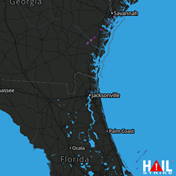 JACKSONVILLE (KJAX) RADAR

