This weather event on March 14, 2025 includes:
2 states
21 counties,
7 cities,
and 64 zip codes.
There were total properties that were impacted and have possible damage.
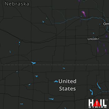 HASTINGS (KUEX) RADAR
States Impacted By Hail On March 14, 2025
Kansas
·
Nebraska
Counties Impacted By Hail On March 14, 2025
Marshall, KS
·
Riley, KS
·
Washington, KS
·
Antelope, NE
·
Butler, NE
·
Cass, NE
·
Colfax, NE
·
Gage, NE
·
Greeley, NE
·
Johnson, NE
·
Lancaster, NE
·
Madison, NE
·
Nance, NE
·
Otoe, NE
·
Pierce, NE
·
Platte, NE
·
Polk, NE
·
Richardson, NE
·
Seward, NE
·
Stanton, NE
·
Wayne, NE
Cities Impacted By Hail On March 14, 2025
Cook, NE
·
Cortland, NE
·
Humboldt, NE
·
Lincoln, NE
·
Lorton, NE
·
Sterling, NE
·
Yankee Hill, NE
Zip Codes Impacted By Hail On March 14, 2025
68317
·
68329
·
68331
·
68332
·
68339
·
68344
·
68346
·
68349
·
68358
·
68366
·
68368
·
68376
·
68382
·
68404
·
68407
·
68410
·
68413
·
68418
·
68422
·
68423
·
68430
·
68442
·
68443
·
68446
·
68448
·
68450
·
68455
·
68458
·
68461
·
68502
·
68506
·
68512
·
68516
·
68520
·
68522
·
68523
·
68524
·
68526
·
68527
·
68528
·
68532
·
68601
·
68623
·
68629
·
68643
·
68661
·
68662
·
68669
·
68701
·
68740
·
68779
·
68882
·
66548
·
66554
·
66933
·
68301
·
68304
·
68310
·
68328
·
68357
·
68631
·
68756
·
68767
·
68768

