This weather event on March 9, 2025 includes:
2 states
29 counties,
18 cities,
and 59 zip codes.
There were 5653 total properties that were impacted and have possible damage.
States Impacted By Hail On March 9, 2025
Alabama
·
Georgia
Counties Impacted By Hail On March 9, 2025
Barbour, AL
·
Bullock, AL
·
Dale, AL
·
Henry, AL
·
Houston, AL
·
Russell, AL
·
Baker, GA
·
Calhoun, GA
·
Chattahoochee, GA
·
Clay, GA
·
Colquitt, GA
·
Cook, GA
·
Crisp, GA
·
Decatur, GA
·
Dougherty, GA
·
Early, GA
·
Lee, GA
·
Marion, GA
·
Miller, GA
·
Mitchell, GA
·
Quitman, GA
·
Randolph, GA
·
Stewart, GA
·
Sumter, GA
·
Terrell, GA
·
Thomas, GA
·
Webster, GA
·
Wilcox, GA
·
Worth, GA
Cities Impacted By Hail On March 9, 2025
Abbeville, AL
·
Albany, GA
·
Arabi, GA
·
Arlington, GA
·
Blakely, GA
·
Boykin, GA
·
Bronwood, GA
·
Columbia, AL
·
Cusseta-Chattahoochee County, GA
·
Eufaula, AL
·
Georgetown-Quitman County, GA
·
Leary, GA
·
Leesburg, GA
·
Midway, AL
·
Morgan, GA
·
Sasser, GA
·
Thomasville, GA
·
Webster County, GA
Zip Codes Impacted By Hail On March 9, 2025
39851
·
39854
·
39862
·
39866
·
39867
·
31015
·
31072
·
31620
·
31701
·
31705
·
31707
·
31709
·
31712
·
31719
·
31721
·
31730
·
31738
·
31743
·
31757
·
31763
·
31764
·
31772
·
31773
·
31780
·
31787
·
31788
·
31792
·
31796
·
31803
·
31805
·
31814
·
31815
·
31821
·
31825
·
31832
·
36005
·
36016
·
36027
·
36048
·
36053
·
36310
·
36317
·
36319
·
36353
·
36374
·
36860
·
36871
·
39813
·
39823
·
39826
·
39837
·
39840
·
39841
·
39842
·
39846
·
39870
·
39877
·
39885
·
39886
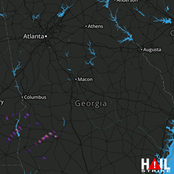 ROBINS AFB (KJGX) RADAR

