This weather event on March 4, 2025 includes:
2 states
29 counties,
19 cities,
and 74 zip codes.
There were 1973 total properties that were impacted and have possible damage.
States Impacted By Hail On March 4, 2025
Oklahoma
·
Texas
Counties Impacted By Hail On March 4, 2025
Bryan, OK
·
Carter, OK
·
Coal, OK
·
Cotton, OK
·
Jefferson, OK
·
Johnston, OK
·
Love, OK
·
Marshall, OK
·
Murray, OK
·
Pontotoc, OK
·
Seminole, OK
·
Archer, TX
·
Callahan, TX
·
Clay, TX
·
Cooke, TX
·
Denton, TX
·
Grayson, TX
·
Hardeman, TX
·
Hood, TX
·
Jack, TX
·
Jones, TX
·
Montague, TX
·
Parker, TX
·
Shackelford, TX
·
Stephens, TX
·
Throckmorton, TX
·
Wichita, TX
·
Wise, TX
·
Young, TX
Cities Impacted By Hail On March 4, 2025
Ada, OK
·
Bridgeport, TX
·
Bryson, TX
·
Byers, TX
·
Fitzhugh, OK
·
Graham, TX
·
Lake Bridgeport, TX
·
Lakeside City, TX
·
Lipan, TX
·
Lone Grove, OK
·
Newcastle, TX
·
Nocona, TX
·
Petrolia, TX
·
Runaway Bay, TX
·
Scotland, TX
·
Silo, OK
·
Sulphur, OK
·
Tishomingo, OK
·
Wichita Falls, TX
Zip Codes Impacted By Hail On March 4, 2025
76049
·
79601
·
79536
·
79525
·
79504
·
79225
·
76491
·
76483
·
76481
·
76464
·
76462
·
76460
·
76459
·
76458
·
76450
·
76437
·
76430
·
76427
·
76426
·
76424
·
76389
·
76379
·
76377
·
76374
·
76372
·
76370
·
76365
·
76357
·
76351
·
76310
·
76308
·
76305
·
76302
·
76270
·
76266
·
76265
·
76255
·
76252
·
76251
·
76249
·
76240
·
76234
·
76230
·
76228
·
76035
·
75092
·
75076
·
74872
·
74871
·
74868
·
74865
·
74856
·
74854
·
74844
·
74843
·
74842
·
74836
·
74820
·
74701
·
74572
·
73573
·
73548
·
73463
·
73460
·
73459
·
73456
·
73453
·
73450
·
73449
·
73446
·
73443
·
73439
·
73401
·
73086
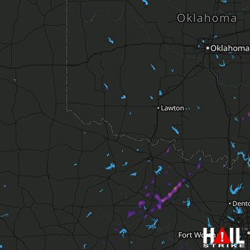 ALTUS AFB (KFDR) RADAR

