This weather event on March 4, 2025 includes:
3 states
20 counties,
18 cities,
and 67 zip codes.
There were 1503 total properties that were impacted and have possible damage.
States Impacted By Hail On March 4, 2025
Iowa
·
Missouri
·
Nebraska
Counties Impacted By Hail On March 4, 2025
Adair, IA
·
Adams, IA
·
Carroll, IA
·
Cass, IA
·
Dallas, IA
·
Fremont, IA
·
Jasper, IA
·
Madison, IA
·
Marion, IA
·
Mills, IA
·
Montgomery, IA
·
Page, IA
·
Polk, IA
·
Pottawattamie, IA
·
Poweshiek, IA
·
Tama, IA
·
Warren, IA
·
Clark, MO
·
Scotland, MO
·
Cass, NE
Cities Impacted By Hail On March 4, 2025
Altoona, IA
·
Ankeny, IA
·
Bartlett, IA
·
Bridgewater, IA
·
Clive, IA
·
Cumming, IA
·
Des Moines, IA
·
Emerson, IA
·
Fontanelle, IA
·
Greenfield, IA
·
Grinnell, IA
·
Hastings, IA
·
Johnston, IA
·
Malvern, IA
·
Mitchellville, IA
·
Oakland Acres, IA
·
Valeria, IA
·
West Des Moines, IA
Zip Codes Impacted By Hail On March 4, 2025
50240
·
50250
·
50009
·
50023
·
50028
·
50035
·
50054
·
50061
·
50070
·
50072
·
50112
·
50131
·
50135
·
50149
·
50157
·
50161
·
50169
·
50208
·
50222
·
50226
·
50237
·
50261
·
50265
·
50266
·
50273
·
50310
·
50313
·
50316
·
50317
·
50325
·
50801
·
50837
·
50841
·
50843
·
50846
·
50849
·
50858
·
50864
·
51401
·
51443
·
51525
·
51532
·
51533
·
51534
·
51535
·
51540
·
51551
·
51560
·
51561
·
51566
·
51573
·
51632
·
51638
·
51653
·
51654
·
52211
·
52215
·
52339
·
63432
·
63453
·
63474
·
63543
·
63563
·
68048
·
68409
·
68413
·
68455
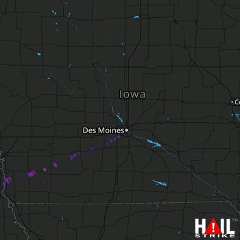 DES MOINES (KDMX) RADAR

