This weather event on March 3, 2025 includes:
2 states
29 counties,
17 cities,
and 80 zip codes.
There were 917 total properties that were impacted and have possible damage.
States Impacted By Hail On March 3, 2025
Iowa
·
Nebraska
Counties Impacted By Hail On March 3, 2025
Adair, IA
·
Adams, IA
·
Cass, IA
·
Dallas, IA
·
Harrison, IA
·
Madison, IA
·
Mills, IA
·
Montgomery, IA
·
Page, IA
·
Polk, IA
·
Pottawattamie, IA
·
Warren, IA
·
Adams, NE
·
Butler, NE
·
Cass, NE
·
Clay, NE
·
Colfax, NE
·
Douglas, NE
·
Hall, NE
·
Hamilton, NE
·
Howard, NE
·
Lancaster, NE
·
Merrick, NE
·
Otoe, NE
·
Platte, NE
·
Polk, NE
·
Saunders, NE
·
Washington, NE
·
York, NE
Cities Impacted By Hail On March 3, 2025
Aurora, NE
·
Avoca, NE
·
Bradshaw, NE
·
Columbus, NE
·
Cumming, IA
·
Des Moines, IA
·
Eagle, NE
·
Grant, IA
·
Hastings, NE
·
Juniata, NE
·
Murray, NE
·
Nehawka, NE
·
Norwalk, IA
·
Trumbull, NE
·
Weeping Water, NE
·
West Des Moines, IA
·
York, NE
Zip Codes Impacted By Hail On March 3, 2025
68832
·
68838
·
68841
·
68843
·
68854
·
68873
·
68901
·
68941
·
68944
·
68954
·
68955
·
68980
·
68112
·
68304
·
68407
·
68409
·
68413
·
68418
·
68831
·
68826
·
68818
·
68661
·
68629
·
68628
·
68624
·
68601
·
68520
·
68467
·
68463
·
68461
·
68460
·
68455
·
68454
·
68371
·
68349
·
68347
·
68319
·
68317
·
68307
·
68064
·
68048
·
68007
·
68003
·
51638
·
51573
·
51566
·
51561
·
51560
·
51556
·
51555
·
51551
·
51549
·
51541
·
51540
·
51535
·
51534
·
51533
·
51532
·
51525
·
50864
·
50859
·
50858
·
50857
·
50853
·
50849
·
50847
·
50846
·
50843
·
50841
·
50837
·
50321
·
50273
·
50266
·
50265
·
50263
·
50261
·
50211
·
50070
·
50061
·
50038
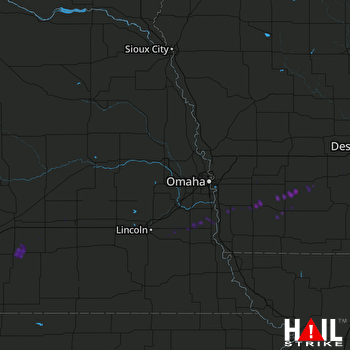 OMAHA (KOAX) RADAR

