This weather event on February 12, 2025 includes:
3 states
24 counties,
16 cities,
and 64 zip codes.
There were 2318 total properties that were impacted and have possible damage.
States Impacted By Hail On February 12, 2025
Louisiana
·
Mississippi
·
Texas
Counties Impacted By Hail On February 12, 2025
Allen, LA
·
Avoyelles, LA
·
Beauregard, LA
·
Caldwell, LA
·
Catahoula, LA
·
Concordia, LA
·
East Feliciana, LA
·
Evangeline, LA
·
Pointe Coupee, LA
·
Rapides, LA
·
St. Helena, LA
·
St. Landry, LA
·
Tensas, LA
·
Vernon, LA
·
West Feliciana, LA
·
Adams, MS
·
Amite, MS
·
Claiborne, MS
·
Franklin, MS
·
Jefferson, MS
·
Lincoln, MS
·
Warren, MS
·
Wilkinson, MS
·
Newton, TX
Cities Impacted By Hail On February 12, 2025
Bude, MS
·
Cheneyville, LA
·
Cottonport, LA
·
Deville, LA
·
Evergreen, LA
·
Fayette, MS
·
Fifth Ward, LA
·
Lecompte, LA
·
Marksville, LA
·
Meadville, MS
·
Merryville, LA
·
Plaucheville, LA
·
Rosepine, LA
·
Singer, LA
·
Sugartown, LA
·
Ville Platte, LA
Zip Codes Impacted By Hail On February 12, 2025
77612
·
75933
·
75928
·
71485
·
71463
·
71446
·
71433
·
71430
·
71418
·
71373
·
71367
·
71366
·
71362
·
71360
·
71355
·
71351
·
71350
·
71346
·
71343
·
71341
·
71334
·
71333
·
71331
·
71328
·
71327
·
71325
·
71323
·
71322
·
71302
·
70775
·
70753
·
70722
·
70712
·
70662
·
70661
·
70660
·
70659
·
70656
·
70655
·
70653
·
70639
·
70634
·
70586
·
70554
·
70441
·
39669
·
39668
·
39664
·
39661
·
39653
·
39647
·
39645
·
39638
·
39633
·
39631
·
39630
·
39629
·
39601
·
39191
·
39180
·
39150
·
39120
·
39096
·
39069
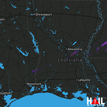 FORT POLK (KPOE) RADAR

