This weather event on February 12, 2025 includes:
3 states
30 counties,
18 cities,
and 56 zip codes.
There were 1119 total properties that were impacted and have possible damage.
States Impacted By Hail On February 12, 2025
Alabama
·
Louisiana
·
Mississippi
Counties Impacted By Hail On February 12, 2025
Choctaw, AL
·
Clarke, AL
·
Escambia, AL
·
Mobile, AL
·
Sumter, AL
·
Washington, AL
·
Tangipahoa, LA
·
Washington, LA
·
Clarke, MS
·
Copiah, MS
·
Covington, MS
·
Forrest, MS
·
George, MS
·
Greene, MS
·
Jackson, MS
·
Jasper, MS
·
Jefferson Davis, MS
·
Jones, MS
·
Lamar, MS
·
Lauderdale, MS
·
Lawrence, MS
·
Lincoln, MS
·
Marion, MS
·
Pearl River, MS
·
Perry, MS
·
Rankin, MS
·
Smith, MS
·
Stone, MS
·
Walthall, MS
·
Wayne, MS
Cities Impacted By Hail On February 12, 2025
Bassfield, MS
·
Brookhaven, MS
·
Coffeeville, AL
·
Gautier, MS
·
Gulf Hills, MS
·
Hattiesburg, MS
·
Heidelberg, MS
·
Lucedale, MS
·
Millry, AL
·
Mount Olive, MS
·
Ocean Springs, MS
·
Pachuta, MS
·
Purvis, MS
·
Raleigh, MS
·
Sharon, MS
·
Soso, MS
·
Stonewall, MS
·
Vancleave, MS
Zip Codes Impacted By Hail On February 12, 2025
35470
·
36502
·
36524
·
36538
·
36545
·
36558
·
36575
·
36587
·
36608
·
36919
·
39044
·
39114
·
39119
·
39153
·
39191
·
39301
·
39330
·
39338
·
39347
·
39355
·
39360
·
39362
·
39363
·
39366
·
39367
·
39401
·
39421
·
39425
·
39427
·
39428
·
39429
·
39437
·
39439
·
39443
·
39451
·
39452
·
39455
·
39462
·
39470
·
39474
·
39475
·
39476
·
39477
·
39479
·
39480
·
39482
·
39483
·
39564
·
39565
·
39577
·
39601
·
39641
·
39656
·
70422
·
70438
·
70444
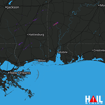 MOBILE (KMOB) RADAR

