This weather event on February 5, 2025 includes:
3 states
37 counties,
10 cities,
and 80 zip codes.
There were 3502 total properties that were impacted and have possible damage.
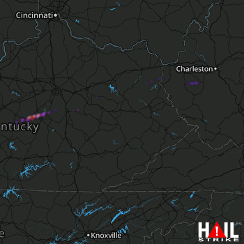 JACKSON (KJKL) RADAR
States Impacted By Hail On February 5, 2025
Kentucky
·
Virginia
·
West Virginia
Counties Impacted By Hail On February 5, 2025
Boyle, KY
·
Breathitt, KY
·
Carter, KY
·
Casey, KY
·
Clark, KY
·
Clay, KY
·
Elliott, KY
·
Estill, KY
·
Fleming, KY
·
Garrard, KY
·
Jessamine, KY
·
Lawrence, KY
·
Lee, KY
·
Lincoln, KY
·
Madison, KY
·
Magoffin, KY
·
Marion, KY
·
Martin, KY
·
Menifee, KY
·
Mercer, KY
·
Montgomery, KY
·
Morgan, KY
·
Pike, KY
·
Powell, KY
·
Pulaski, KY
·
Russell, KY
·
Taylor, KY
·
Washington, KY
·
Wayne, KY
·
Wolfe, KY
·
Russell, VA
·
Smyth, VA
·
Washington, VA
·
Boone, WV
·
Lincoln, WV
·
Logan, WV
·
Wayne, WV
Cities Impacted By Hail On February 5, 2025
Belfry, KY
·
Burgin, KY
·
Danville, KY
·
Harrodsburg, KY
·
Jeffersonville, KY
·
Lebanon, KY
·
Mount Gay-Shamrock, WV
·
Perryville, KY
·
Prichard, WV
·
Saltville, VA
Zip Codes Impacted By Hail On February 5, 2025
24210
·
24266
·
24370
·
24609
·
25022
·
25121
·
25183
·
25501
·
25506
·
25508
·
25521
·
25529
·
25535
·
25540
·
25555
·
25557
·
25565
·
25570
·
25573
·
25601
·
25637
·
25646
·
25649
·
25654
·
40009
·
40033
·
40060
·
40069
·
40310
·
40312
·
40322
·
40328
·
40330
·
40336
·
40337
·
40346
·
40356
·
40371
·
40385
·
40391
·
40419
·
40422
·
40437
·
40444
·
40461
·
40464
·
40468
·
40475
·
40484
·
40962
·
40983
·
41041
·
41129
·
41132
·
41143
·
41149
·
41164
·
41171
·
41180
·
41203
·
41224
·
41230
·
41301
·
41311
·
41339
·
41465
·
41472
·
41501
·
41514
·
41519
·
41527
·
41531
·
41535
·
41557
·
41564
·
42539
·
42544
·
42633
·
42642
·
42733

