This weather event on January 19, 2025 includes:
1 states
10 counties,
26 cities,
and 43 zip codes.
There were 5043 total properties that were impacted and have possible damage.
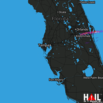 TAMPA (KTBW) RADAR
States Impacted By Hail On January 19, 2025
Florida
Counties Impacted By Hail On January 19, 2025
Brevard, FL
·
DeSoto, FL
·
Hardee, FL
·
Highlands, FL
·
Manatee, FL
·
Okeechobee, FL
·
Orange, FL
·
Osceola, FL
·
Polk, FL
·
Sarasota, FL
Cities Impacted By Hail On January 19, 2025
Bee Ridge, FL
·
Cape Canaveral, FL
·
Cocoa, FL
·
Cocoa Beach, FL
·
Cocoa West, FL
·
Fort Green, FL
·
Fort Green Springs, FL
·
Frostproof, FL
·
Fruitville, FL
·
Gardner, FL
·
Indialantic, FL
·
June Park, FL
·
Lake Mary Jane, FL
·
Melbourne, FL
·
Melbourne Beach, FL
·
Merritt Island, FL
·
Ona, FL
·
Palm Bay, FL
·
Rockledge, FL
·
Sarasota Springs, FL
·
Sharpes, FL
·
Siesta Key, FL
·
Southeast Arcadia, FL
·
South Gate Ridge, FL
·
South Sarasota, FL
·
West Melbourne, FL
Zip Codes Impacted By Hail On January 19, 2025
34972
·
34773
·
34771
·
34739
·
34268
·
34266
·
34251
·
34242
·
34240
·
34233
·
34232
·
34231
·
34219
·
33960
·
33898
·
33890
·
33873
·
33865
·
33857
·
33852
·
33843
·
33841
·
33834
·
33825
·
32955
·
32953
·
32952
·
32951
·
32948
·
32940
·
32931
·
32927
·
32926
·
32922
·
32920
·
32909
·
32908
·
32907
·
32905
·
32904
·
32901
·
32832
·
32709

