This weather event on December 29, 2024 includes:
2 states
23 counties,
23 cities,
and 64 zip codes.
There were 573 total properties that were impacted and have possible damage.
States Impacted By Hail On December 29, 2024
Alabama
·
Georgia
Counties Impacted By Hail On December 29, 2024
Bullock, AL
·
Calhoun, AL
·
Chambers, AL
·
Crenshaw, AL
·
Elmore, AL
·
Lee, AL
·
Macon, AL
·
Montgomery, AL
·
Pike, AL
·
Russell, AL
·
Talladega, AL
·
Tallapoosa, AL
·
Coweta, GA
·
Fayette, GA
·
Fulton, GA
·
Harris, GA
·
Meriwether, GA
·
Spalding, GA
·
Stewart, GA
·
Talbot, GA
·
Troup, GA
·
Upson, GA
·
Walker, GA
Cities Impacted By Hail On December 29, 2024
Alexandria, AL
·
Auburn, AL
·
Camp Hill, AL
·
Chattahoochee Hills, GA
·
Franklin, AL
·
Loachapoka, AL
·
Montgomery, AL
·
Newnan, GA
·
Notasulga, AL
·
Opelika, AL
·
Palmetto, GA
·
Peachtree City, GA
·
Phenix City, AL
·
Pike Road, AL
·
Reeltown, AL
·
Richland, GA
·
Sharpsburg, GA
·
Shorter, AL
·
Tallassee, AL
·
The Rock, GA
·
Troy, AL
·
Tuskegee, AL
·
Tyrone, GA
Zip Codes Impacted By Hail On December 29, 2024
30205
·
30213
·
30263
·
30265
·
30268
·
30269
·
30277
·
30290
·
30293
·
30707
·
30728
·
30731
·
31804
·
31811
·
31816
·
31822
·
31823
·
31825
·
31827
·
31830
·
31833
·
35096
·
36013
·
36024
·
36029
·
36035
·
36036
·
36039
·
36049
·
36052
·
36064
·
36069
·
36075
·
36078
·
36079
·
36081
·
36083
·
36088
·
36089
·
36092
·
36105
·
36116
·
36117
·
36250
·
36260
·
36271
·
36804
·
36830
·
36832
·
36850
·
36853
·
36854
·
36860
·
36866
·
36867
·
36869
·
36870
·
36874
·
36877
·
36879
·
30285
·
30286
·
31815
·
36852
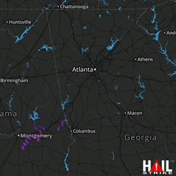 ATLANTA (KFFC) RADAR

