This weather event on December 17, 2024 includes:
2 states
17 counties,
23 cities,
and 54 zip codes.
There were 1381 total properties that were impacted and have possible damage.
States Impacted By Hail On December 17, 2024
Arkansas
·
Oklahoma
Counties Impacted By Hail On December 17, 2024
Crawford, AR
·
Izard, AR
·
Pope, AR
·
Scott, AR
·
Sebastian, AR
·
Stone, AR
·
Washington, AR
·
Adair, OK
·
Atoka, OK
·
Cherokee, OK
·
Choctaw, OK
·
Haskell, OK
·
Latimer, OK
·
Le Flore, OK
·
Pittsburg, OK
·
Pushmataha, OK
·
Sequoyah, OK
Cities Impacted By Hail On December 17, 2024
Alderson, OK
·
Arkoma, OK
·
Arpelar, OK
·
Canadian, OK
·
Central City, AR
·
Dry Creek, OK
·
Evening Shade, OK
·
Farmington, AR
·
Fayetteville, AR
·
Flute Springs, OK
·
Fort Smith, AR
·
Greasy, OK
·
Haileyville, OK
·
Krebs, OK
·
Liberty, OK
·
Long, OK
·
Longtown, OK
·
McAlester, OK
·
Moffett, OK
·
Panola, OK
·
Savanna, OK
·
Van Buren, AR
·
Wilburton, OK
Zip Codes Impacted By Hail On December 17, 2024
72533
·
72556
·
72560
·
72680
·
72704
·
72730
·
72837
·
72903
·
72904
·
72916
·
72921
·
72927
·
72941
·
72946
·
72952
·
72956
·
74425
·
74427
·
74430
·
74432
·
74462
·
74501
·
74522
·
74525
·
74536
·
74543
·
74546
·
74547
·
74552
·
74553
·
74554
·
74558
·
74561
·
74562
·
74563
·
74565
·
74567
·
74570
·
74571
·
74576
·
74578
·
74727
·
74759
·
74931
·
74941
·
74944
·
74945
·
74946
·
74948
·
74954
·
74962
·
74966
·
72901
·
74901
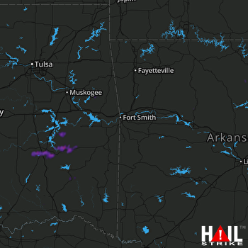 FORT SMITH (KSRX) RADAR

