This weather event on November 12, 2024 includes:
2 states
33 counties,
13 cities,
and 88 zip codes.
There were 289 total properties that were impacted and have possible damage.
States Impacted By Hail On November 12, 2024
Kansas
·
Nebraska
Counties Impacted By Hail On November 12, 2024
Barton, KS
·
Clay, KS
·
Cloud, KS
·
Dickinson, KS
·
Ellis, KS
·
Ellsworth, KS
·
Jewell, KS
·
Lincoln, KS
·
McPherson, KS
·
Mitchell, KS
·
Ness, KS
·
Norton, KS
·
Osborne, KS
·
Ottawa, KS
·
Pawnee, KS
·
Rice, KS
·
Rush, KS
·
Saline, KS
·
Stafford, KS
·
Trego, KS
·
Washington, KS
·
Adams, NE
·
Franklin, NE
·
Furnas, NE
·
Gage, NE
·
Harlan, NE
·
Kearney, NE
·
Lancaster, NE
·
Nuckolls, NE
·
Pawnee, NE
·
Phelps, NE
·
Thayer, NE
·
Webster, NE
Cities Impacted By Hail On November 12, 2024
Ada, KS
·
Barnard, KS
·
Bladen, NE
·
Blue Springs, NE
·
Brookville, KS
·
Denton, NE
·
Great Bend, KS
·
Hildreth, NE
·
Minden, NE
·
Morganville, KS
·
Simpson, KS
·
Susank, KS
·
Tescott, KS
Zip Codes Impacted By Hail On November 12, 2024
66901
·
66933
·
66936
·
66937
·
66943
·
66949
·
66956
·
66962
·
66970
·
67401
·
67410
·
67417
·
67418
·
67423
·
67425
·
67432
·
67436
·
67439
·
67442
·
67445
·
67450
·
67454
·
67455
·
67457
·
67458
·
67460
·
67464
·
67466
·
67467
·
67468
·
67470
·
67473
·
67478
·
67481
·
67484
·
67487
·
67490
·
67491
·
67511
·
67521
·
67525
·
67530
·
67544
·
67550
·
67556
·
67564
·
67567
·
67601
·
67622
·
67637
·
67646
·
67654
·
67664
·
68310
·
68318
·
68323
·
68339
·
68370
·
68381
·
68920
·
68924
·
68925
·
68926
·
68928
·
68929
·
68932
·
68939
·
68940
·
68945
·
68947
·
68949
·
68950
·
68959
·
68960
·
68966
·
68967
·
68970
·
68971
·
68972
·
68973
·
68977
·
68978
·
68981
·
68982
·
66938
·
67420
·
67447
·
68333
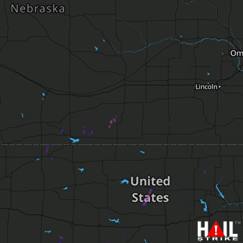 HASTINGS (KUEX) RADAR

