This weather event on November 3, 2024 includes:
2 states
27 counties,
14 cities,
and 63 zip codes.
There were 1603 total properties that were impacted and have possible damage.
States Impacted By Hail On November 3, 2024
Kansas
·
Nebraska
Counties Impacted By Hail On November 3, 2024
Jewell, KS
·
Lincoln, KS
·
Mitchell, KS
·
Osborne, KS
·
Ottawa, KS
·
Rooks, KS
·
Smith, KS
·
Adams, NE
·
Antelope, NE
·
Boone, NE
·
Butler, NE
·
Clay, NE
·
Colfax, NE
·
Franklin, NE
·
Greeley, NE
·
Hall, NE
·
Hamilton, NE
·
Kearney, NE
·
Madison, NE
·
Merrick, NE
·
Nance, NE
·
Pierce, NE
·
Platte, NE
·
Polk, NE
·
Sherman, NE
·
Valley, NE
·
Webster, NE
Cities Impacted By Hail On November 3, 2024
Alda, NE
·
Campbell, NE
·
Central City, NE
·
Columbus, NE
·
Genoa, NE
·
Grand Island, NE
·
Greeley Center, NE
·
Loretto, NE
·
North Loup, NE
·
Overland, NE
·
Phillips, NE
·
Richland, NE
·
Scotia, NE
·
Shelby, NE
Zip Codes Impacted By Hail On November 3, 2024
66941
·
66952
·
67418
·
67437
·
67445
·
67452
·
67467
·
67485
·
67649
·
67651
·
67673
·
68601
·
68620
·
68624
·
68628
·
68638
·
68640
·
68651
·
68652
·
68655
·
68658
·
68661
·
68662
·
68663
·
68665
·
68752
·
68758
·
68781
·
68801
·
68803
·
68810
·
68815
·
68818
·
68826
·
68827
·
68832
·
68842
·
68846
·
68853
·
68854
·
68859
·
68862
·
68864
·
68865
·
68875
·
68883
·
68925
·
68928
·
68930
·
68932
·
68942
·
68950
·
68952
·
68954
·
68955
·
68956
·
68959
·
68970
·
68972
·
68973
·
67420
·
67663
·
68901
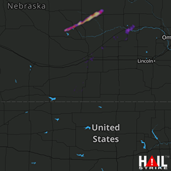 HASTINGS (KUEX) RADAR

