This weather event on November 3, 2024 includes:
2 states
23 counties,
5 cities,
and 67 zip codes.
There were total properties that were impacted and have possible damage.
States Impacted By Hail On November 3, 2024
Kansas
·
Nebraska
Counties Impacted By Hail On November 3, 2024
Barton, KS
·
Butler, KS
·
Chase, KS
·
Chautauqua, KS
·
Clay, KS
·
Cloud, KS
·
Ellsworth, KS
·
Greenwood, KS
·
Lincoln, KS
·
Lyon, KS
·
Marion, KS
·
McPherson, KS
·
Ottawa, KS
·
Reno, KS
·
Republic, KS
·
Rice, KS
·
Sedgwick, KS
·
Stafford, KS
·
Sumner, KS
·
Fillmore, NE
·
Gage, NE
·
Jefferson, NE
·
Saline, NE
Cities Impacted By Hail On November 3, 2024
Emporia, KS
·
Fairbury, NE
·
Haysville, KS
·
Odin, KS
·
Wichita, KS
Zip Codes Impacted By Hail On November 3, 2024
66801
·
66840
·
66843
·
66850
·
66858
·
66860
·
66861
·
66865
·
66901
·
66935
·
66940
·
66959
·
66960
·
66966
·
67002
·
67010
·
67026
·
67037
·
67042
·
67060
·
67074
·
67123
·
67133
·
67215
·
67216
·
67217
·
67344
·
67352
·
67361
·
67422
·
67423
·
67425
·
67427
·
67432
·
67436
·
67439
·
67444
·
67445
·
67450
·
67454
·
67455
·
67459
·
67460
·
67464
·
67467
·
67468
·
67484
·
67490
·
67512
·
67525
·
67526
·
67545
·
67568
·
67573
·
67578
·
67579
·
67581
·
68331
·
68352
·
68358
·
68377
·
68416
·
68422
·
68424
·
68453
·
68301
·
67120
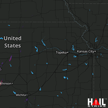 TOPEKA (KTWX) RADAR

