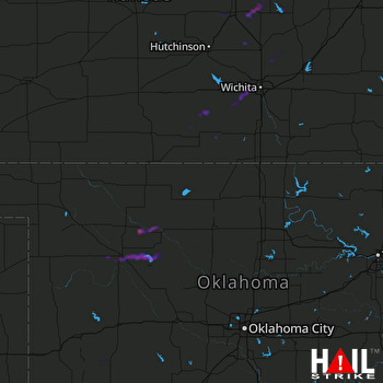
This weather event on October 21, 2024 includes:
2 states
18 counties,
16 cities,
and 75 zip codes.
There were 3501 total properties that were impacted and have possible damage.
States Impacted By Hail On October 21, 2024
Kansas
·
Oklahoma
Counties Impacted By Hail On October 21, 2024
Barber, KS
·
Butler, KS
·
Harper, KS
·
Harvey, KS
·
Kingman, KS
·
Marion, KS
·
McPherson, KS
·
Saline, KS
·
Sedgwick, KS
·
Sumner, KS
·
Alfalfa, OK
·
Blaine, OK
·
Dewey, OK
·
Garfield, OK
·
Major, OK
·
Washita, OK
·
Woods, OK
·
Woodward, OK
Cities Impacted By Hail On October 21, 2024
Amorita, OK
·
Argonia, KS
·
Attica, KS
·
Burlington, OK
·
Canton, KS
·
Goddard, KS
·
Hesston, KS
·
Leon, KS
·
Longdale, OK
·
Maize, KS
·
McPherson, KS
·
Norwich, KS
·
Seiling, OK
·
Sentinel, OK
·
Valley Center, KS
·
Wichita, KS
Zip Codes Impacted By Hail On October 21, 2024
66858
·
67003
·
67004
·
67009
·
67017
·
67018
·
67020
·
67025
·
67026
·
67030
·
67036
·
67049
·
67052
·
67056
·
67058
·
67061
·
67062
·
67063
·
67068
·
67070
·
67073
·
67074
·
67101
·
67106
·
67107
·
67114
·
67118
·
67135
·
67142
·
67147
·
67149
·
67150
·
67152
·
67154
·
67159
·
67203
·
67204
·
67209
·
67212
·
67213
·
67214
·
67215
·
67227
·
67235
·
67428
·
67438
·
67443
·
67448
·
67460
·
67475
·
67483
·
73661
·
73663
·
73664
·
73718
·
73719
·
73722
·
73724
·
73728
·
73729
·
73735
·
73737
·
73747
·
73755
·
73758
·
73763
·
73773
·
73838
·
73852
·
73853
·
73859
·
73860
·
67416
·
67205
·
66861
 VANCE AFB (KVNX) RADAR

