This weather event on October 20, 2024 includes:
5 states
27 counties,
11 cities,
and 68 zip codes.
There were 481 total properties that were impacted and have possible damage.
States Impacted By Hail On October 20, 2024
Colorado
·
Kansas
·
New Mexico
·
Oklahoma
·
Texas
Counties Impacted By Hail On October 20, 2024
Baca, CO
·
Meade, KS
·
Seward, KS
·
Curry, NM
·
De Baca, NM
·
Guadalupe, NM
·
Harding, NM
·
Quay, NM
·
Roosevelt, NM
·
San Miguel, NM
·
Union, NM
·
Beaver, OK
·
Texas, OK
·
Bailey, TX
·
Castro, TX
·
Cochran, TX
·
Dallam, TX
·
Deaf Smith, TX
·
Hansford, TX
·
Hartley, TX
·
Moore, TX
·
Ochiltree, TX
·
Oldham, TX
·
Parmer, TX
·
Potter, TX
·
Roberts, TX
·
Sherman, TX
Cities Impacted By Hail On October 20, 2024
Clovis, NM
·
Conchas Dam, NM
·
Grady, NM
·
Gruver, TX
·
Guymon, OK
·
Hartley, TX
·
Hooker, OK
·
House, NM
·
Newkirk, NM
·
Perryton, TX
·
Tucumcari, NM
Zip Codes Impacted By Hail On October 20, 2024
67869
·
67901
·
73932
·
73938
·
73939
·
73942
·
73944
·
73949
·
73950
·
73951
·
79001
·
79018
·
79022
·
79029
·
79035
·
79040
·
79044
·
79045
·
79058
·
79059
·
79062
·
79070
·
79081
·
79083
·
79084
·
79086
·
79092
·
79325
·
79344
·
79346
·
79347
·
79371
·
81029
·
81064
·
87730
·
87733
·
87743
·
87746
·
88101
·
88112
·
88113
·
88116
·
88118
·
88120
·
88121
·
88124
·
88125
·
88130
·
88134
·
88135
·
88401
·
88410
·
88411
·
88415
·
88416
·
88417
·
88418
·
88419
·
88422
·
88424
·
88426
·
88427
·
88430
·
88431
·
88434
·
88435
·
73945
·
88119
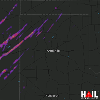 AMARILLO (KAMA) RADAR

