This weather event on October 9, 2024 includes:
1 states
15 counties,
28 cities,
and 54 zip codes.
There were 352 total properties that were impacted and have possible damage.
States Impacted By Hail On October 9, 2024
Florida
Counties Impacted By Hail On October 9, 2024
Broward, FL
·
Charlotte, FL
·
Collier, FL
·
DeSoto, FL
·
Glades, FL
·
Hendry, FL
·
Highlands, FL
·
Indian River, FL
·
Lee, FL
·
Martin, FL
·
Miami-Dade, FL
·
Monroe, FL
·
Okeechobee, FL
·
Palm Beach, FL
·
St. Lucie, FL
Cities Impacted By Hail On October 9, 2024
Belle Glade, FL
·
Big Pine Key, FL
·
Buckhead Ridge, FL
·
Canal Point, FL
·
Cypress Quarters, FL
·
Fort Pierce North, FL
·
Fort Pierce South, FL
·
Hutchinson Island South, FL
·
Indian River Estates, FL
·
Indiantown, FL
·
Island Walk, FL
·
Jensen Beach, FL
·
Jupiter, FL
·
Jupiter Farms, FL
·
Lakewood Park, FL
·
Montura, FL
·
North Fort Myers, FL
·
Ocean Breeze Park, FL
·
Okeechobee, FL
·
Port Salerno, FL
·
Port St. Lucie, FL
·
River Park, FL
·
Southeast Arcadia, FL
·
St. Lucie Village, FL
·
Suncoast Estates, FL
·
Wellington, FL
·
Weston, FL
·
White City, FL
Zip Codes Impacted By Hail On October 9, 2024
32966
·
33031
·
33034
·
33042
·
33043
·
33178
·
33187
·
33194
·
33327
·
33332
·
33430
·
33438
·
33440
·
33455
·
33470
·
33471
·
33476
·
33478
·
33852
·
33857
·
33870
·
33876
·
33917
·
33960
·
33982
·
34114
·
34119
·
34120
·
34138
·
34141
·
34142
·
34266
·
34945
·
34946
·
34947
·
34949
·
34950
·
34951
·
34952
·
34953
·
34956
·
34957
·
34972
·
34974
·
34981
·
34982
·
34983
·
34984
·
34986
·
34987
·
34990
·
34996
·
34997
·
33944
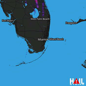 MIAMI (KAMX) RADAR

