This weather event on October 6, 2024 includes:
2 states
20 counties,
27 cities,
and 86 zip codes.
There were 247 total properties that were impacted and have possible damage.
States Impacted By Hail On October 6, 2024
Ohio
·
West Virginia
Counties Impacted By Hail On October 6, 2024
Athens, OH
·
Brown, OH
·
Coshocton, OH
·
Gallia, OH
·
Hocking, OH
·
Jackson, OH
·
Meigs, OH
·
Morgan, OH
·
Muskingum, OH
·
Ross, OH
·
Scioto, OH
·
Tuscarawas, OH
·
Vinton, OH
·
Washington, OH
·
Jackson, WV
·
Mason, WV
·
Pleasants, WV
·
Ritchie, WV
·
Wirt, WV
·
Wood, WV
Cities Impacted By Hail On October 6, 2024
Athens, OH
·
Belmont, WV
·
Belpre, OH
·
Blennerhassett, WV
·
Boaz, WV
·
Cheshire, OH
·
Chesterhill, OH
·
Coshocton, OH
·
Glouster, OH
·
Haydenville, OH
·
Jacksonville, OH
·
Marietta, OH
·
McArthur, OH
·
Middleport, OH
·
Minford, OH
·
Newport, OH
·
North Hills, WV
·
Parkersburg, WV
·
Ravenswood, WV
·
St. Marys, WV
·
Stone Creek, OH
·
Trimble, OH
·
Vienna, WV
·
Vinton, OH
·
Washington, WV
·
Waverly, WV
·
Williamstown, WV
Zip Codes Impacted By Hail On October 6, 2024
25262
·
25287
·
25550
·
26101
·
26104
·
26105
·
26133
·
26134
·
26142
·
26143
·
26146
·
26148
·
26150
·
26161
·
26164
·
26170
·
26180
·
26181
·
26184
·
26187
·
26337
·
43127
·
43135
·
43138
·
43158
·
43728
·
43787
·
43812
·
43821
·
43824
·
43832
·
43837
·
43845
·
44663
·
45167
·
45168
·
45601
·
45614
·
45620
·
45631
·
45634
·
45644
·
45647
·
45651
·
45652
·
45653
·
45654
·
45656
·
45657
·
45672
·
45682
·
45685
·
45686
·
45690
·
45692
·
45695
·
45698
·
45701
·
45710
·
45711
·
45714
·
45723
·
45724
·
45729
·
45732
·
45735
·
45740
·
45741
·
45742
·
45743
·
45750
·
45760
·
45761
·
45764
·
45766
·
45768
·
45769
·
45770
·
45771
·
45772
·
45775
·
45776
·
45782
·
45784
·
43840
·
43701
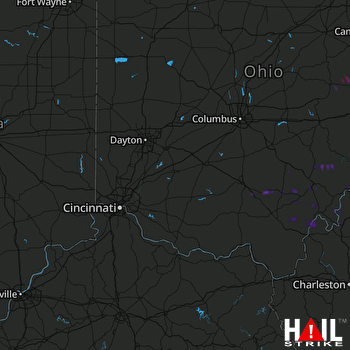 CINCINNATI (KILN) RADAR

