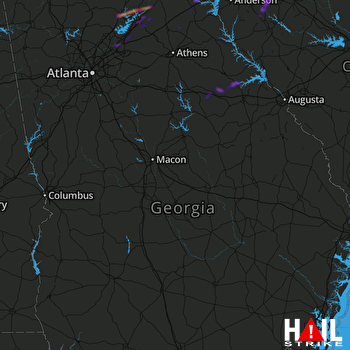
This weather event on September 24, 2024 includes:
2 states
26 counties,
24 cities,
and 54 zip codes.
There were 98 total properties that were impacted and have possible damage.
States Impacted By Hail On September 24, 2024
Georgia
·
South Carolina
Counties Impacted By Hail On September 24, 2024
Banks, GA
·
Dawson, GA
·
Forsyth, GA
·
Franklin, GA
·
Fulton, GA
·
Greene, GA
·
Gwinnett, GA
·
Habersham, GA
·
Hall, GA
·
Hancock, GA
·
Hart, GA
·
Lumpkin, GA
·
Madison, GA
·
McDuffie, GA
·
Putnam, GA
·
Stephens, GA
·
Taliaferro, GA
·
Warren, GA
·
White, GA
·
Wilkes, GA
·
Abbeville, SC
·
Anderson, SC
·
Greenwood, SC
·
Laurens, SC
·
Oconee, SC
·
Pickens, SC
Cities Impacted By Hail On September 24, 2024
Alto, GA
·
Buford, GA
·
Clemson, SC
·
Crawfordville, GA
·
Dahlonega, GA
·
Duluth, GA
·
Fair Play, SC
·
Flowery Branch, GA
·
Gainesville, GA
·
Gillsville, GA
·
Gumlog, GA
·
Johns Creek, GA
·
Lavonia, GA
·
Lula, GA
·
Oakwood, GA
·
Pendleton, SC
·
Raoul, GA
·
Seneca, SC
·
Sharon, GA
·
Sugar Hill, GA
·
Suwanee, GA
·
Union Point, GA
·
Utica, SC
·
Ware Shoals, SC
Zip Codes Impacted By Hail On September 24, 2024
29360
·
29630
·
29631
·
29634
·
29643
·
29645
·
29653
·
29654
·
29670
·
29672
·
29678
·
29692
·
29693
·
30024
·
30028
·
30096
·
30097
·
30501
·
30504
·
30506
·
30507
·
30510
·
30518
·
30519
·
30520
·
30523
·
30527
·
30528
·
30531
·
30533
·
30534
·
30542
·
30543
·
30545
·
30553
·
30554
·
30557
·
30564
·
30571
·
30625
·
30631
·
30633
·
30642
·
30662
·
30664
·
30669
·
30673
·
30678
·
30817
·
30821
·
30824
·
31024
·
31087
·
29638
 ROBINS AFB (KJGX) RADAR

